
Route: The walk starts in Gwersyllt and crosses the River Alyn. There is also varied woodland, the Caer Alyn hill fort and a variety of bridges (3.75 miles/approximately two hours).
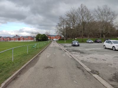
This walk can start at Alyn Waters Country Park, Mold Road, LL11 4AG (grid reference SJ 319, 546) or from the railway station in Gwersyllt Village (grid reference SJ 318, 533). Gwersyllt is one of Wrexham’s largest villages, situated about two miles northwest of the town centre. The village expanded quickly due to the coal mining industry in the area. Several collieries were open at one time, and you can still see their remains around the region today.
The walk takes you through the village, across open farmland, across rivers and streams, along quiet wooded valleys, and also passes remnants of the area’s varied and diverse history.
Parking:
Alyn Waters Country Park has a small car park (£1 all day).
Buses:
Arriva bus numbers 26, 32 and 33 will take you to the park. Call 01978 266 166 for bus information.
Railway:
Call National Rail Enquiries on 03457 484 950 for train times to and from Gwersyllt Station or visit nationalrail.co.uk for details.
Map:
Ordnance Survey Explorer Map 256 covers the area.
This route may be muddy in places, and we recommend suitable footwear. There are also stiles, steep slopes and busy roads to negotiate.
The route is not suitable for wheelchairs, buggies or small children. Some stiles might require you to lift a dog over them.
The Visitor Centre at Alyn Waters Country Park offers the visitor the chance to grab a bite to eat, purchase a drink, pop to the toilet or pick up a leaflet about the Park and surrounding area. One of the interesting facts you can discover is that the Park contains one of the most extensive community woodlands in Wales, planted in the early 1990s.
Walk Directions
Face the front of the Alyn Water Country Park Visitor Centre and take the path between the centre and the play area to the right, following the tarmac surfaced path. Pass the playground on your right and the wooden fence on your left. Further along to your right, you can see an area of grassland with three curious green round-topped metal posts. This land is a skylark management area – listen out for their call from February onwards.
As you continue along the path, you’ll see lots of birch trees to your left, part of the community woodland planted in the 1990s. Also worthy of note are the numerous metal objects on the stone plinths to your left. The soil is nutrient-poor here but is ideal for orchids.
Ahead, you will see a black pedestrian barrier, walk through this, and carry on along the tarmac track in front of you. You’ll pass Bradley Bowling Club on your right and a cricket pitch on your left (1). Gwersyllt Park Cricket Club was established in 1883.
The Wauns
When you arrive at Park Wall Road, turn right and walk along the pavement for approximately 100 metres. Enter the playing fields on the left through the green gate.
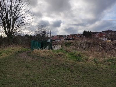
These fields are known as ‘The Wauns’. Head towards the houses in the far right corner at the end of the field. You will see a metal green palisade fence (2), take the path immediately to its left and you will arrive at Glan Llyn Road.
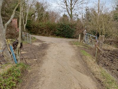
Turn left, go along the road for 175 yards and follow the footpath sign you see on your right. You will pass garden fences on your left as you approach an old metal kissing gate. Pass through the gate and take a minute to look at Alpaca Avenue on your right (3).

Sweet Chestnut Tree
Take the left path that goes around the base of the hill, keeping the garden fences on your left. You’ll also pass a pool on your left. Continue to follow the fence line and bear left slightly downhill as you walk past hawthorn and holly trees. Keep to the left as you reach another metal kissing gate. Go over the farm track that runs from left to right in front of you. You will notice a distinctive sweet chestnut tree (4) in front of you with rabbit burrows in the bank beyond.
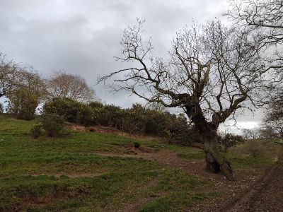
The sweet chestnut is not native to Britain but was probably first transported from the Mediterranean and Asia Minor by the Romans. The tree’s distinctive large leaves are about 20cm long, with prominent veins and serrated edges.
Scale the slope in front of you, keeping the gorse to your right. In the summer months, you might hear the seed cases bursting open with a popping noise, scattering the tiny seeds up to 30 feet in all directions. Gorse flowers are bright yellow, and they have a smell of coconut.
There is also a large cherry tree (you can see the ripe cherries in July and August) and an oak tree next to each other on your left as you reach the top of the slope. Notice the line of hawthorn trees to your left.
Continue to the end of the gorse bushes and turn right down the steepish slope. When you reach the bottom, turn left and follow the track, keeping the trees and stream to your right.
Blocked Tunnel
Presently, you’ll see the remains of a brick structure with a large earth bank on either side of it to your right. These earthworks are the remains of a weir. The stream used to originate from a large “fish” pond. There was also a sluice gate where the stream met the pond further along the track you crossed earlier. Today the pond is filled in and the land is a wet scrubby field. The stream still collects excess water from the surrounding areas. Continue along the path.
There will be another metal kissing gate to the left of the blocked-off tunnel ahead. Go through this and walk up the slope to meet the B5425, Llay New Road. Cross the road carefully and take the footpath directly in front of you. Follow the path down to another kissing gate and you’ll emerge into an open field.
Continue diagonally right and head for the kissing gate about 50 metres ahead. As you walk downhill, listen to the babbling brook on your right. Go through the gate, over a small bridge and onto a narrow surfaced lane. Turn right and follow the route round to the left.
With the stone wall on your left, head towards the buildings. On the drive in front of you, there is a narrow metal stile to the right of a double metal field gate. Cross over the stile and carry on downhill towards another set of double metal field gates. There’s a gap to the right of these gates next to the corner of the stone building. Go through the gap and over a wooden stile, then walk downhill in-between the fencing to the bottom.
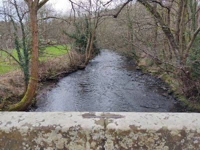
Bridge Over the River Alyn
You will see the remains of an old corn mill on your right. Builders channelled water from the River Alyn through a sluice and into the mill. There was also a weir here just north of the mill.
Step over a tiny stream and cross the large bridge in front of you. The bridge spans the River Alyn (5), a tributary of the River Dee. The Alyn starts its journey in Llandegla, Denbighshire and travels through Loggerheads, Mold and Gwersyllt before joining the River Dee by the Trevalyn Meadows in Rossett.
Turn right and follow the river around the hill to the left. Skirt around the base of the higher land bearing left until you see the Wilderness Farm and Mill House buildings in front of you on the banks of the river.

Caer Alyn Hill Fort
Caer Alyn, an iron age hill fort, sits on the crest of the hill to your left. You can also see an unusual flat-topped elevation to your right on the top of the slope on the other side of the river (6). This “hill” is actually a slag heap.
The Caer Alyn Volunteer Group is working on a wide range of heritage-related projects on the site. It includes an iron age promontory fort, a possible bronze age tumulus in an adjacent field, and Wat’s Dyke, which follows the fort’s western side. For more information about the Fort or if you would also like to become a volunteer with them, please go to caeralyn.org.
We hope you’re enjoying the Gwersyllt and River Alyn walk. Click here for more walk articles.
Wat’s Dyke Way
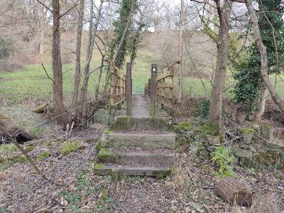
Hop over the stile to the right of the metal gate in front of you. At the time of writing, the lovely 16th-century bridge to your right is closed pending repairs to a wall. You are now joining the Wat’s Dyke Way National Trail, which we saw on last month’s walk along the River Dee.
Look at the different tree species and the splendid display of buttercups in late spring and early summer here. You will notice an Environment Agency building on your right across the field. This building measures the water level in the River Alyn.
Carry on over the cattle grid and along Lon Pont y Capel. Turn left at the T-junction (7) after going over another cattle grid and head up the lane. As the road bears to the right, you will see a footpath and stile on your left. Hop over the stile, walk up the slope and climb the wooden steps before emerging at the top into an open field.
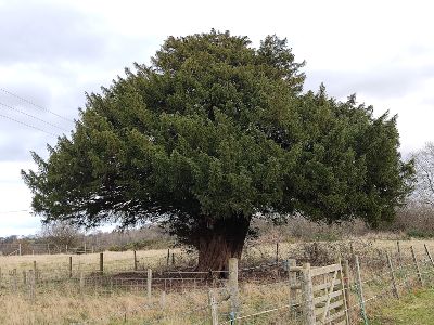
Splendid Yew Tree
Head across the field towards a stile in the fence line (passing to the right of a splendid mature yew tree) (8). Cross the stile and turn right. Go through the metal gate and follow the edge of the field past the farm buildings until you reach the stile in the far left corner. Hop over the stile onto a lane (this lane leads to The Caer Alyn iron age hill fort mentioned earlier).
Cross the road and go through the silver-coloured kissing gate into a field with a dilapidated caravan to your right. Head straight across the field and take the metal kissing gate you can see between the two telegraph posts. Follow the path down to the B5425 Llay New Road that you crossed earlier.
Cross Llay New Road and take the footpath opposite (you are still on the Wat’s Dyke Way National Trail and will be until you enter the Llay side of Alyn Waters Country Park). Carry on along the footpath, ignoring the stiles on the right until you reach the end of the green chain link fence. Keep following the path around the houses until you reach Park Lane.
Turn left and left again after a few minutes at the junction onto Barretts Hill. Head downhill and, as you follow the road to the right, you can see the houses of Bradley on top of the hillside.
Pass the new build with the semi-circular roof and cross the impressive stone bridge (9). Turn right directly afterwards back into Alyn Waters Country Park. Follow the path that runs alongside the river. Cross a little wooden bridge and look down at the strange terracotta-like colour of the stones. These are iron deposits leaching from the ground and are not harmful.
Take care as you cross a boardwalk over a wet area. Look at the different plant species growing in this small area; all adapted to living in such wet conditions. The earth path becomes a tarmac one – follow it back towards the Visitor Centre.
Congratulations! You have finished the walk.
Leave gates and property as you find them | Protect plants and animals and take your litter home |
Keep dogs under close control | Consider other people
If you experience any problems on this walk or if you would like to make any other comment, contact Public Rights of Way, telephone 01978 292 057 or visit wrexham.gov.uk/rightsofway
Finally, thank you for reading ‘Gwersyllt and River Alyn Circular Walk’. For more walk articles, click here.