
We return for a second visit to Overton this month. Its location means it has potential walks in every direction, so I’m sure we’ll be back at some point to explore the region to the west of the village.
“Pre-Amble”
The walk covers the area to the east of Overton and is about 3½ miles. You’ll be walking across green meadows for most of the time, so you will encounter cows and sheep every now and again.
There is a difficult-to-negotiate stile at one point, followed by a 50-yard walk along the main road between Overton and Penley. You’ll definitely need ankle-high boots if you decide to tackle the walk during periods of wet weather, as the terrain gets pretty slippery and muddy.
The gentle nature of the walk is demonstrated by the total ascent only being 230 feet (70 metres), and the highest point being 222 feet (67 metres). It should take you a little under two hours.
The route seemed reasonably dog-friendly as I only walked through a few fields containing livestock. However, the number of non-dog-friendly stiles is substantial, so bear that in mind if you have to lift your dog over them. There are stretches along country lanes where you would need to keep your dog on a lead.
Starting Point
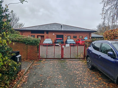
I started at the car park behind the Two Doves café on Church Road in Overton (LL13 0EE; what3words.com//instilled.flopping.wedding). Take the A528 if coming from Wrexham or Ellesmere, or the A539 if arriving from the direction of Penley. Church Road is behind St Mary’s Church. Take care not to confuse St Mary’s with the Methodist Church opposite the café.
Disclaimer
Important: Your safety is our top priority. Before attempting any of our walks, you must read and understand the disclaimer at love-wrexham.com/walk-disclaimer.
Always remember to read ahead of your current position in the walk directions in case we mention an upcoming potential hazard.
Walk Directions
Church Street Car Park
Turn left out of the car park and walk up Church Road, passing the church on your left. It then turns into School Lane. You’ll see St Mary’s School on your right a couple of minutes after leaving the car park.
Turn right onto the short approach to the dark red school gates (1).
Turn left just before you reach them, then follow the path around the perimeter of the school, keeping the tall, black metal fence to your right. Exit the path through the metal kissing gate on your left.
Ignore the metal gate on the corner of the hedgerows ahead of you when you enter this field. Instead, walk straight on, following the right-hand hedgerow. You’ll pass a couple of solitary oak trees and a white farmhouse diagonally left ahead of you. Turn right through the metal walker’s gate just after the second oak tree.
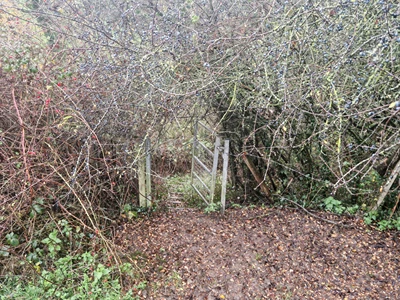
Walk along the left-hand hedge and fence line until you’ve almost reached the end of the field, and then turn left through and go through the metal gate. You might have to duck to avoid the archway of brambles overhead. Walk diagonally right and exit the field through another metal gate a short distance away.
Large, Black Water Butt
Head diagonally left after entering the next field. Walk under the cables and exit through the metal gate in the hedgerow beyond. Head straight across the next field and down into the dip. Exit this field through either the vehicle gateway or through the metal walker’s gate (2).
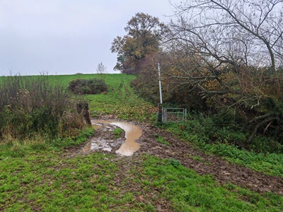
Climb the rise in the next field, following the right-hand hedgerow and trees. After 150 yards or so, exit the field on the right through the metal gateway. Walk straight on and down the slope. Go through the gate at the bottom, about 100 yards to the right of the track, up to the farm. You’ll see a large, black water butt next to the gate and a yellow arrow waymarker on the wooden gatepost (3).
Go up the slope in the next field, heading roughly to the right of the farm buildings.
As you reach the farm building, go through the two white gates with the farm drive in between (4).
Head slightly diagonally right and hop over the stile ahead in the far fence line. Walk down into the dip and cross the stream using the left-hand bridge with the stile at either end (5).
A word of warning: the planks on the bridge were incredibly slippery, so please exercise extreme caution as you walk over them.
Dilapidated Building
Head up the field on the other side. You can walk up the “gulley” with the hillocks on either side and then follow the path to the right of the destroyed brick outbuilding (6).
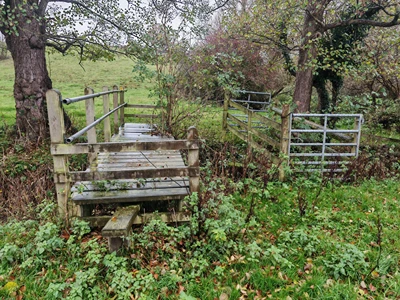
Go through the gate into the field and follow the fence of the house on the left. Gird your loins before climbing over the stile in the hedgerow ahead.
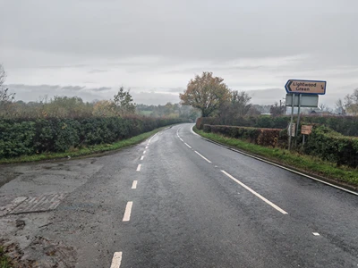
We’ve scaled some pretty rubbishy stiles in our time, haven’t we? This is one of the worst, however. It’s narrow. The step is wobbly, and there are brambles on either side. I did get over it in the end, but please be careful, especially as you step down onto the A539 from Overton to Penley on the other side.
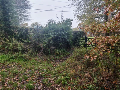
Cross over and turn right, heading towards the “Lightwood Green ¼” signpost in about 100 yards (7).
Turn left and walk along the lane for a few minutes. You’ll come to a T-junction with two bridlepath signs. Go left and follow the lane around to the right. Turn right just before the large wooden gate. Turn right through the wooden gate on the right after about 150 yards, as the path turns sharply left (8).

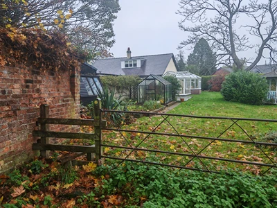
Walk across the lawn, through the gate and in between the house and an outbuilding on the left.
Lightwood
Go straight on, ignoring the bridlepath sign to the right. Open the gate using the horse-rider lever and the metal ring. Obviously, the sheep in the field are fiendishly clever ones! Walk the short distance across the field and go through the gate ahead, using the yellow-topped horse-rider lever.
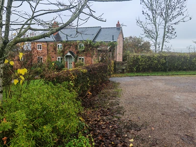
Turn right a little further on here at the yellow chevron and walk along the narrow path, possibly over some fallen apples, and through the wooden gate. Go straight on past Lightwood/Lightwood Bungalow on your left. At the next house on the left – Mona Cottage – turn into the drive after the house itself and then turn left again. You’ll spot a stile ahead (9).
Hop over and follow the left-hand hedge line in the next field right into the far left-hand corner. Duck down under the low-hanging branches (10).
Walk down the wooden steps cut into the bank until you reach the stile that takes you onto the lane.
Electricity House
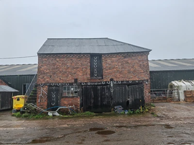
Turn left and walk between the farmhouse and its outbuildings. Don’t miss the structure on the left with all the horseshoes (11).
Carry on along the drive, passing the “Mud on Road. Cattle” sign. Turn right down the concrete track as the road bends around to the left.
Walk along this track for about four to five minutes. Go through the metal gate and walk up the field. Exit through the stile with blue plastic tubing to the right of the metal gate. Head diagonally left underneath the oak tree. Exit the field over the rather magnificent stile to the right of the metal gate.
You now cross a series of six other stiles, all more or less in a straight line. As you cross the fifth, follow the left-hand hedgerow and cross the sixth into the garden of Electricity House (12).
Walk up the drive to the main road – A539. Cross over and walk up Church Road and back to the car park where you started.
Congratulations! You’ve completed the walk!
We hope you enjoyed reading “Overton Revisited: Eastern Loop”. Click here for more of our local walk articles.
