
Your starting point is in the centre of Ruabon for this 6½-mile walk around the area east of the town. I’ve recently reduced the length of my walks, but this one was impossible to shorten due to the sheer diversity of landmarks in the area.
The route is relatively flat throughout, with a total ascent of only 419 feet (128 metres), with the highest point reaches 460 feet (140 metres). It should take you about 2½ hours.
“Pre-Amble”
You’ll be walking through fields of crops for the most part of this walk. Please note that if you cover the route in mid-summer, you may encounter wheat that is difficult to walk through. However, it should not be enough to cause you to get lost if you stick to the directions.
There is a 100-yard stretch along the A539 Ruabon to Overton road, which you’ll have to take care when following, as there is no pavement, only a grass verge on the left.
Starting Point
I started off in the main car park in Ruabon. If you’re using the A483 to get there, come off at junction 1. Take the A539 towards Ruabon and come off at the fourth exit. Head into Ruabon on the B5605. Go past the Wynnstay Arms and turn right after 200 yards into Maes-y-Llan Lane. The entrance to the free car park is about 25 yards on the right.
The car park address is Maes-Y-Llan Lane, Ruabon (what3words.com/hopeless.alone.presented).
Disclaimer
Important: Your safety is our top priority. Before attempting any of our walks, you must read and understand the disclaimer at love-wrexham.com/walk-disclaimer.
Always remember to read ahead of your current position in the walk directions in case we mention an upcoming potential hazard.
Walk Directions
Bridge Over the A483
Exit the car park onto Maes-y-Llan lane and turn right. Walk about 200 yards and turn right at the Orchard Grove sign (1).
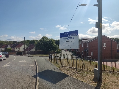
Walk along the road with the new houses on either side, cross the bridge over the A483 and turn right down the stone steps.
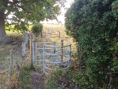
Go through the metal kissing gate into the small field. Follow the left-hand hedge line and go through the metal kissing gate in front of the white house ahead. Turn left and follow the narrow path for a couple of minutes. Go through a metal walker’s gate and then a cattle gate marked “Please close the gate” and follow the left-hand hedge and tree line up the field (2).
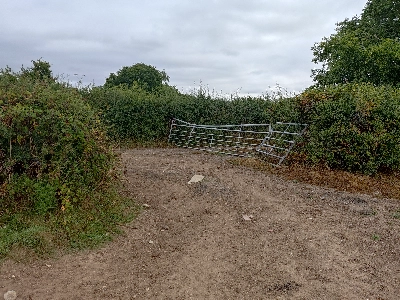
Exit the field through the gate in the left-hand corner as you look at it. Squeeze along the narrow path and around the left of the temporary fence in front of you with the wasp’s nest warning. Don’t worry. You’re heading in the opposite direction.
Turn right so you’re walking with the hedge and fence line on your right. Follow the path for about four minutes. Walk down into the slight dip with the weeds and go right under the trees before re-emerging left and following the right-hand hedge line again to the metal gate and onto the A539 Ruabon to Erbistock road.
Wynnstay Estate
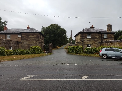
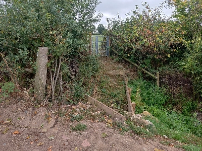
Turn left once through the gate and then right between the gateway cottages onto the Wynnstay Estate driveway (3).
Walk about 25 yards and look for the yellow arrow waymarker post on your left, half-hidden by the undergrowth (4).
Stand facing down the drive. Turn 45° left and cross the wheat field in that direction (southeast). Look for the stile in the far fence line and cross it into another wheat field.
Walk across this field in a line halfway between the fence line running to your right and the grove of trees in the middle of the field (south). There’s another stile in the far fence and tree line that leads you onto a woodland path (5).
Carved Owl
Walk along the path for a few yards and then leave it, picking up another path to your left. You’ll soon reach a drive running across you with some houses on the other side. Turn left and walk along the drive for a short while until you exit the Wynnstay Estate between two more gateway cottages.
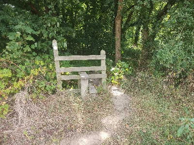
Look to your left and follow the public footpath sign arrow on the other side of the road. Hop over the log stile. Follow the path made in the ground across the field, passing to the left of the wooden electricity pole. Exit over the stile into another field. Walk straight on in an east-south-east direction (following the path between the stalks of corn if they are still there). Cross the stile onto a drive after a few minutes (6).
Go diagonally left after crossing the stile and head into the garden of the grand house in front (7).
Take the gravel path and walk past the greenhouse and the carved owl. Cross the stile in the hedge 25 yards ahead of you. Use the top step only, as the lower one is far too wobbly to use. Follow the right-hand hedgeline for about 200 yards and then turn right over the stile and duckboard bridge.
Yellow Oak Road
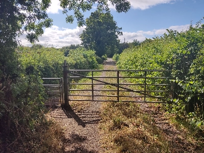
Turn left and follow the left-hand hedgeline for around 12-15 minutes until you reach the left-hand corner of the field. Exit through the metal kissing gate, follow the left-hand hedgerow and turn left through another metal gate a few yards afterwards.
Continue straight, passing through the metal gate ahead, following the arrow on the metal footpath sign. Ignore the green metal vehicle gate and drive to the left. Follow the path into a large field and exit using the metal gate in the fence line running across you. Follow the left-hand fence line as it curves around the trees. You’ll see another gate in the fence line ahead of you.
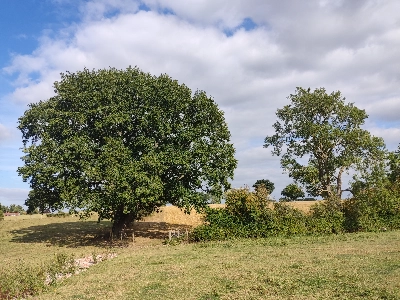
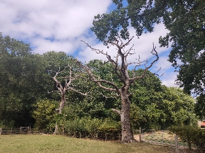
Once through the gate, head to the left of the green oak tree and the blasted oak tree ahead. Walk around the fence to the left of the green oak and continue downhill. Walk through the gateway ahead with an even larger oak making a canopy overhead (8).
You’ll see the remnants of a yellow arrow waymarker disc on the left-hand wooden post with an undamaged one on the opposite side.
Quoin Cottage
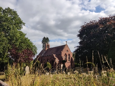
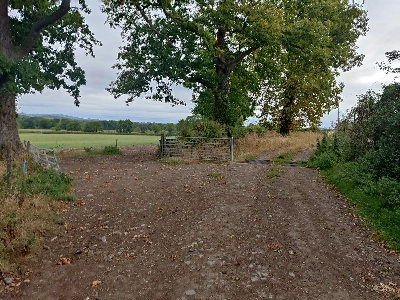
Follow the left-hand hedge and fence line up the slope and exit the field through the metal kissing gate after about four minutes. You’ll see a church a short distance ahead of you. Turn left on the concrete drive and cross the cattle grid by Quoin Cottage onto the lane. Go straight on and take the first turning on the left onto Yellow Oak Road after a couple of minutes.
** If you turn right at Quoin Cottage, you can visit the charming All Saints Church, Pen-y-Lan, which is about a minute’s walk away (9). **
Ignore the road to the left after about seven minutes or 0.3 miles, and go straight on along the gravel track, which bears around to the right, for about four minutes until you walk past a house on your left. Go through the wooden gate in the fence dead ahead.
Follow the right-hand hedge and fence line, past the two blasted oaks (10).
Go over the stile and walk straight on along the woodland path for about three minutes. You may hear the baying of hounds to your right. Exit the woodland over the stile. Cross the field, aiming to walk along the immediate left of the house ahead. You’ll see the stile to exit the field onto the A539 where the hedge ahead meets the house boundary. It’s a narrow squeeze, and take care as you reach the busy road.
Moreton Farm
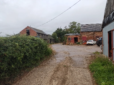
Cross over and turn right. Walk 100 yards before turning left onto Cinders Lane. Walk 0.75 miles or about 15 minutes and turn left onto the track leading to Moreton Farm (11).
You’ll walk past the front of a farmhouse after about 0.65 miles or around 12 minutes. Stay on the track as it bends 45° to the right around the farm buildings, cow sheds and grain store (12).
Turn left through the open gateway just before the cattle grid (13).
Turn left again and follow the track around the perimeter of the field between the left-hand hedgerow and the electric fence. Go through the larger of the two gaps at the bottom of the field and onto the stony earth track (14).
Wooden Box Structure
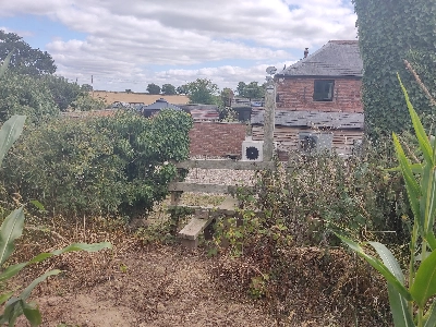
Turn left and walk as far as the two large cattle gates ahead of you and the walker’s gate on your right. Go through the left-hand gateway and turn 45° left around the hedge. Walk over the small wooden box structure and up through the metal walker’s gate into a field (15).
Turn right and follow the right-hand hedge, fence and tree line. Exit the field through the walker’s gate to the right of the larger gate. Descend the short bank and turn left along the path following the yellow waymarker arrow signpost (16). This lower path gets a little overgrown towards the end, but it’s still passable.
Go through the metal gate at the end of the path, turn right and follow the right-hand hedge, fence and tree line for a short way along the corn field.
Allotments
Go through the metal gate and cross the duckboards. Follow the right-hand hedge, fence and tree line up to the far hedge line of the wheat field. Don’t turn right through the gateway, but cross the stile in front of you, go up the step and through the gate into the next field. Follow the right-hand hedge, fence and tree line up another steepish wheat field.
Go through a metal gate, taking care with the uneven ground just before it (a metal stake is sticking out of the ground as well). Pass some farm buildings and a farm yard on your right, and go through a gap in the hedge line ahead of you. Walk diagonally right to join the hedge line. You’ll pass an open gateway (there was a Nike slider wedged in the left-hand post when I passed!)
Continue along this large field using the track that follows the right-hand hedge and tree line. Go right through the metal gate on the right at the end of the field, turn left and then right. You’ll see another wasp’s nest warning at this junction of paths. Descend the steep track, go through another metal gate and past the allotment on the left (17).
The road bends to the left and then right as you cross the bridge over the A483 that you crossed at the beginning of the walk. Retrace your steps along Maes-y-Llan back to the car park.
Congratulations! You’ve completed the walk!
We hope you enjoyed reading “Walk Around Ruabon East”. Click here for more of our local walk articles.
