
I thought we’d take advantage of the all-weather paths in Llandegla this month, while, at the same time, seeing what the western area has to offer. You won’t be disappointed as the going underfoot is nice and firm and unaffected by the recent rains.
“Pre-Amble”
You’ll be walking along broad gravel tracks for the most part. As always, when walking in Llandegla, be on the constant lookout for cyclists, as they can appear in the unlikeliest of places. The walk takes you east before turning west to link with Wat’s Dyke Way. You then head south before re-entering Llandegla and heading east back to the starting point.
The walk covers about 4½ miles, and you should be able to complete it in about 2-2½ hours.
There are a couple of steepish climbs, so the total ascent is 835 feet (255 metres), with the highest point being 1517 feet (462 metres).
The route seemed reasonably dog-friendly in that I didn’t walk through any fields containing livestock. There were also very few stiles. You would need to keep your dog on a lead on some of the tracks through Llandegla because of the presence of cyclists.
Starting Point
I started next to the turn-off from the A525 up to Llandegla One Planet Adventure (what3words.com/pile.commutes.snuggled).
Take the A525 out of Wrexham towards Ruthin. Turn left when you reach the turn-off left for Llandega One Planet. Turn right immediately, and you’ll see a parking area ahead of you.
You can, of course, park at One Planet. Parking there costs £7 per car for the whole day, with an additional charge of £2 per passenger.
Disclaimer
Important: Your safety is our top priority. Before attempting any of our walks, you must read and understand the disclaimer at love-wrexham.com/walk-disclaimer.
Always remember to read ahead of your current position in the walk directions in case we mention an upcoming potential hazard.
Walk Directions
Parking
When you get to the turning off the A525 up to Llandegla One Planet, turn left off the main road and then immediately right so you’re actually heading away from the visitor centre.
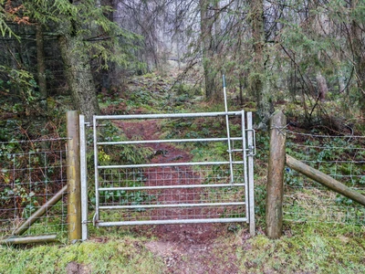
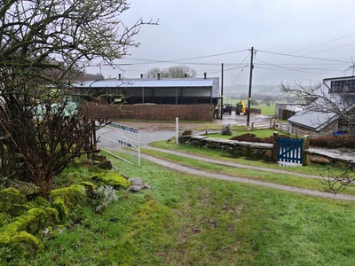
There are parking spaces on either side of the side road. Head back the way you drove to the parking and turn right, following the bridle path sign on your right. Go through the horse gate to the left of the wooden vehicle gates and walk up the well-maintained concrete drive with the grass verges in the middle.
After about seven or eight minutes’ walk, you’ll reach a point where you can take a sharp right to a house, but we go straight on through the wooden gate with the blue vertical arrow. Walk a few yards up the right-hand edge of a field, through a metal gate, and turn left along the woodland path into the beginnings of Llandegla forest (1).
** REMEMBER THIS POINT AS YOU WILL RETURN HERE FROM THE OPPOSITE DIRECTION TOWARDS THE END OF THE WALK **
Llandegla
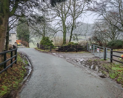
Carry straight on northeast, ignore the steep descent to the left, and continue to the gravel road (2).
Look both ways and make sure no cyclists are coming. Turn left over the stream, then right up the track marked ‘No Construction Traffic’. Now, even though this is a public footpath, I suspect there may be bikes coming from all from both directions, so keep your wits about you, listen out and keep to one side of the road to one side of the track.
You’ll know you’re on the right track because after about 30 seconds, you’ll see a grass vehicle track heading off to your right diagonally, with a fenced-off area just beyond it, enclosing some sort of reservoir or pool. However, we’re going straight up on the gravel/chipping path. As you get to the top of the path, you’ll see that the track you’re on starts to bend sharply to the left. You’ll see a sign saying ‘The Dark Side’ on your left. Turn right here and walk along the narrow path with the two grassy banks falling to both sides. On the left, you’ll see the lovely Pendinas reservoir.
Pendinas Reservoir
As you reach the end of the reservoir, keep following the gravel path around to the right. You’ll walk past a gated-off metal structure with some steps that control the flow of the water channel to your right into the reservoir (3).
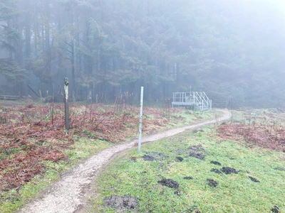
Walk across this bridge and follow it around to the left. Then, almost immediately, turn right following the green way marker arrow on the wooden post.
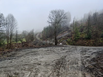
Be careful here because there are a lot of different ways you can go, but you’re following the green way marker arrow on that wooden post right into another forested area. After a minute or so, you’ll come to a series of wooden frames, and although none of them tells you to turn right, that’s what we’re doing. You’ll hit a clearing after about seven or eight minutes walking, where they’ve been felling trees.
If you’re using the Ordnance Survey map app, you’ll see how it shows we’re straying from the green-dotted public footpath. This happens several times inside Llandegla, and I can only deduce that, over the years, the public footpaths have ceased to exist, and the trails are now the way to move through the forest.
Wat’s Dyke Way
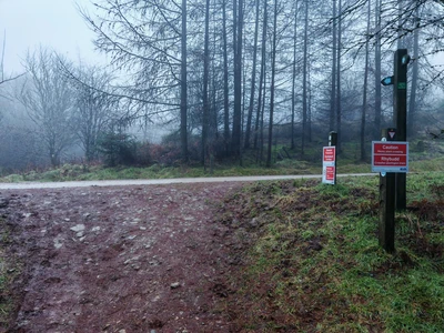
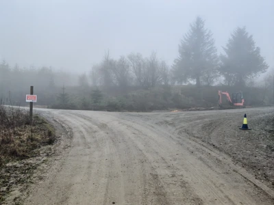
About three or four minutes after the area of cleared trees, you’ll come to a T-junction. Ignore the paths ahead of you and turn left up the wide gravel chipping vehicle path for about three to four minutes. You’ll see a sign saying ‘Construction Traffic’ to the left, but we’re turning right (4), and you are now back on the Ordnance Survey indicated public footpath after a slight detour.
This is another wide vehicle track of gravel and chippings, and we’re walking along a stretch with mature trees to our left and saplings to our right.
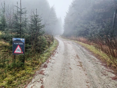
After about 20-25 minutes’ walk, you’ll come to a ‘Slow Down’ sign, with a bike inside a red triangle, so you’ll know you’re coming to the junction with Watt’s Dyke Way (5).
After you pass that sign, you’ll see a wooden post with a green waymarker arrow on it. You’ll also see a path coming down from your left. Turn right down the track with the waymarker post on either side and head downhill into a heavily forested area. After about two to three minutes of descent, you’ll come to a ‘crosspaths’. Go straight over, but look left and right in case any cyclists are heading onto the path across you.
Continue to head downhill as the route gives way to a stretch of more open ground on either side. This path had turned into a bit of a stream when I walked down, so I hope you’ve got your boots on if you’re doing this walk after a spell of wet weather.
The Sleeper Bridge
After about 10 minutes of leaving that top track, you’ll come to another crosspaths. Again, look each way to make sure no cyclists are approaching and cross quickly over (don’t dilly-dally while crossing because it’s a blind rise to your left, so you’ll want to get across this bit as quickly as you can). Carry on straight on down the path indicated by the blueway marker arrow on the short wooden post.
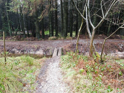
Carry on downhill. A few minutes later, you’ll cross a narrow double sleeper bridge over a brook (6). Here, you want to turn left and walk along the right-hand bank of the brook for a few yards before turning right.
You’ll come to another bridge and a short post with a white arrow waymarker. Turn right over a cycle path and then down a narrow path.
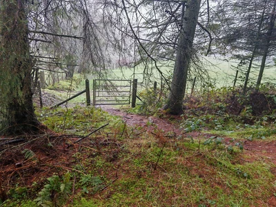
About a minute later, you’ll come to another crosspaths. Again, cyclists might be coming from either side, so be careful as you cross over. There’s a cycle path to your first left, but then slightly lower down and a few yards beyond it is another path, which is the one you want to take (7).
Walk down the path, so the higher one is up to your left, and continue downhill on this rocky woodland track. You’ll know you’re on the right path because you reach a point at the bottom of a slope where you have to cross a stream. There are two wooden bridges covered with wire netting to your left. However, I would not advise using those because the step down from the first one is rather badly damaged, so I would just stick to the path. Once over the stream, follow the path round to the left.
Exiting the Forest
It becomes distinctly less stony. This may be a cycle path as well as a footpath, so you need to be mindful all the time that there could be cyclists approaching from both directions. Anyway, continue walking down the path that has the stream you’ve just crossed running alongside it to the left. As the path levels out, you have to duck under two fallen trees.
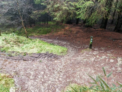
You’ll see there’s another track running parallel to you on the left. You come to another crosspaths as you cross quite a wide vehicle track. Cross straight over (8) and go straight down the path on the other side of the track, following the blue waymarker arrow with the acorn inside.
You’ve exited the forested area now, and you have a section of clearer ground to your right and pine to your left. You can see hills, valleys and green meadows ahead of you.
Don’t miss the dramatic view a few minutes later as you look left down into a steep-sided river valley with the meadows and fields beyond. A minute or so later, you’ll walk through a wooden gateway with a bench to your right and an information board headed Llandegla Forest.
Continue down the stony path which winds around to your left. Be careful, as this is a steep bit. It leads you down to the wooden fence of a house a bit further down. It says ‘Private Garden’. Continue walking down the path with this wooden fence running alongside you on your left, and you come to a series of houses and a car parking area through a white gate with ‘Offa’s Dyke Path’ written on it.
A525
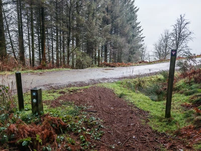
Turn right as you hit the tarmac road (9) and walk between the group of rather attractive houses.
Seven or eight minutes after walking through the small hamlet, you’ll come to a cream-coloured house on your left and an aluminium vehicle gate on your right with an aluminium walking gate just to the right of it (10).
Go through the gate, walk up the short path and hop over the stile to the left of the next aluminium gate a few yards further along. You find yourself on another path with the forest to your right, open fields down to your left, and the A525 going towards Ruthin.
You’ll stay on this track now until you reach the point you entered Llandega at the point I asterisked at the beginning of the walk.
Shortly after taking the stile, turn left off the track and walk along the grassy lower path for about five minutes. Take the diagonal turn-off right up the slope to join a higher path. Stay on this track for the next half mile until you drop down into an area that has been cleared of trees. There’s a wooden gate to your left and a sign saying ‘Warning’ with a yellow triangle ahead of you.
Walk past the yellow triangle sign (11) and keep to the path that rises sharply in front of you for the next mile. It climbs before eventually levelling out.
You’ll see another path slightly above you to the right, which looks like it has some wooden boarded sections for cyclists. Turn left just after you pass the farm buildings on the left (12) and retrace your steps down the slope back to where you parked.
Congratulations – you have finished the walk!
We hope you enjoyed reading “Exploring Llandegla West and Wat’s Dyke Way”. Click here for more of our walk features.
