
We’re going to be taking another look at the northeastern-most part of our county over the next few months. Our first venture into that part of Wrexham is to visit Sutton Green.
“Pre-Amble”
You’ll start by walking down to the River Dee and then heading in an anti-clockwise direction for about two miles until you reach your starting point again. The walk then takes you further south to the River Clywedog, before you join up with the Dee again and return to your starting point.
The walk covers about 5 miles, and you should be able to complete it in about 2½-3 hours.
As you’re never far from a river, the walk is pretty flat. The total ascent is only 131 feet (40 metres), with the highest point being 89 feet (27 metres).
The route seemed reasonably dog-friendly. However, you do cross an area of ground-nesting birds and a badger reserve, so you would absolutely need to keep your dog on a lead in those places. You are also close to rivers with steep, unfenced banks at multiple points along the way.
Starting Point
I started in the middle of Sutton Green (what3words.com/projects.gangs.dentistry). I couldn’t find any car parks in the area, so I left my car on one of the grass verges. If you decide to do the walk, please try to take only one car so as not to cause too much disturbance.
Take the A525 south out of Wrexham. Take the second exit on the large roundabout about a minute after leaving Marchwiel. Turn left onto the B5130 towards Cross Lanes a few seconds later. Pass the Co-op on your left and continue along the B5130 for 1¾ miles. Turn right down Sun Lane for just over half a mile and park where you see fit.
Walk Directions
Rodens Hall Road
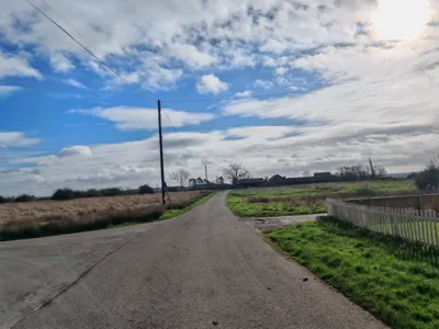
Start at the junction of Sun Lane and Rodens Hall Road. Head east down Sun Lane towards the dead end (1).
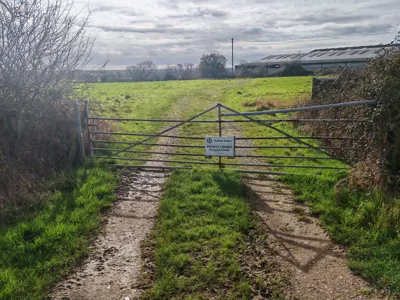
Keep to the lane as it bends left and ignore the track to the houses straight on. Walk past the green metal public footpath signpost. If you look at the hedge to your right, you’ll see a stile. Don’t take it as the planks leading to it are rotted away, and the stile itself is completely overgrown. Instead, walk on a few yards and step over the metal gate with the sign saying “Sutton Green Private Fishing” to your right (2).
Walk down the gravel track. Just before you get to the gap in the hedge at the bottom of the slope, turn right and walk across the bottom of the field so the hedge is on your left. As you reach the corner of the field, hop over the stile on the left and pick your way across the broken bridge.
Step carefully over the low electric fence to the right and follow the left-hand hedge, fence and tree line as far as the banks of the River Dee. Climb over the stile to the left (3).
Follow the path along the riverbank. After a few minutes, go through the gap in the fence ahead to the right of a dilapidated wooden stile. You’ll see a white sign saying “Bangor-on-Dee SAA: Private Fishing Downstream”.
Two Oak Trees
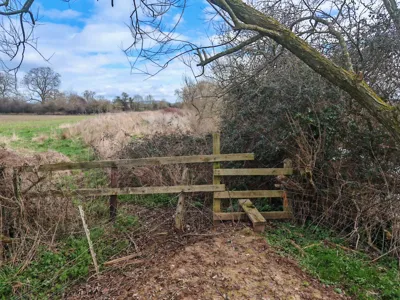
Carry on along the riverbank for about 7-8 minutes. Follow the course of the river as it bends sharply to the left. Walk as far as the line of trees ahead of you and turn left just before you reach them. Walk about three minutes following the line of trees on your right until you reach a stile on your right, located in a gap in the trees (4).
This may seem like an overly complicated way to reach the gap, but there are no real reference points in the field, so these directions are the safest way to get to this stile. The yellow warning sign about walking your dog is missing the right-hand diagonal piece, although a complete version of the same sign is lying on the ground by the stile.
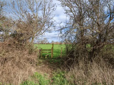
Once over the stile, you’ll see the riverbank dead ahead. Walk along it for a few yards and then turn diagonally left away from it at the point with the two oak trees – the left one is alive, and the right one is dead (5).
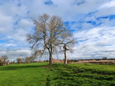
Head for the double stile to the left of the oak tree, which leans to the left and forms a vegetation archway with the smaller tree to its left.
Rubber Hose
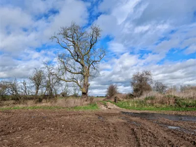
The first stile is missing the vertical support on the far side, so take care climbing down off it. You’ll come to a large field with the remains of corn stalks in it (at this time of year, anyway). If you look across the field, you’ll see a solitary large oak. Head across the muddy field towards the oak. If you’re doing this walk in the summertime, it could well be that the corn prevents you from crossing the field directly, so you’ll have to walk around the perimeter. As you reach the large oak tree, take the path to its right to leave the field (6).
Keep on the path until you see the parking sign for the Bangor-on-Dee Salmon Anglers Limited. Turn left at the ‘T-junction’. Walk west, passing to the right of the abandoned piece of farming machinery and over the rubber hose. Go through the left of the two metal gateways ahead.
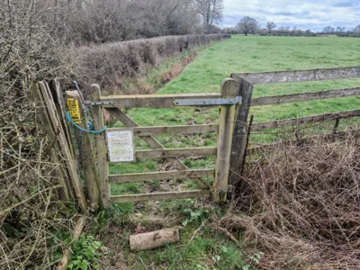
Head for the right-hand edge of the copse of trees ahead, known as Sutton Green Fox Covert. Turn left through the gate just after the trees finish.
Ground-Nesting Birds
Follow the instructions on the gate, ie turn right and follow the hedge line to your right around the field until you reach the gap (7).
Again, it may be tempting to follow the public footpath route on the Ordnance Survey map and walk diagonally across the field, but the landowner has apparently good reason for you to follow the hedgeline.
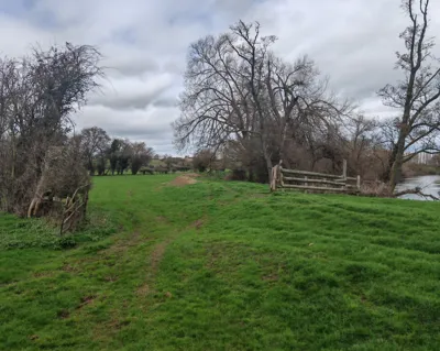
Go through the gap. Walk around the pond and ‘refollow’ the right-hand hedge line as far as the stile. Hop over the stile, walk across the duckboard bridge with the metal mesh. Turn left when you reach Rodens Hall Road and carry on down to the crossroads. Be careful with your dog, as this area is the one with the ground-nesting birds.
You’re now at the point where you started the walk. You can finish here or carry on with part two. If you want to continue, head down Sun Lane in the same direction as you started the first part of the walk, but turn right almost immediately, following the arrow on the green metal public footpath signpost (8).

River Clywedog
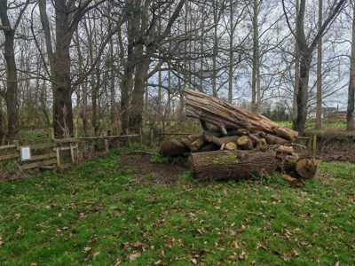
Hop over the stile after a minute or so and walk along the earth track for about seven minutes. You go through a gateway with a yellow arrow waymarker. Turn left over the stile with another yellow arrow waymarker as you reach the concrete bridge ahead of you. Walk across the field to the right edge of the woods ahead and to the left to the River Clywedog. You’ll see a stile on your left a few yards after a wooden gate in the same fence, with a pile of large tree trunks next to it (9). The sign tells you to keep your dog on a lead because of badgers!
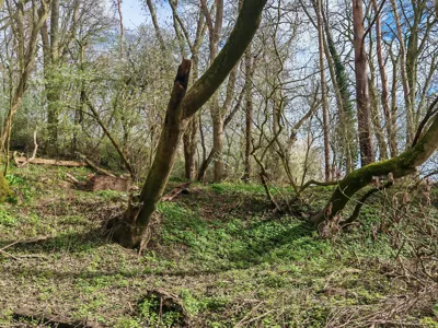
Hop over the stile into the wooded area. This is important – remember that the stile to exit the wood is about 200 yards directly ahead of you. As you leave the stile, you’ll see a yellow arrow waymarker on a tree in front of you that directs you left up a bank. If it’s been raining and the ground is wet, that’s probably the right choice. Head up the bank and bear right until you drop down again and head left to reach the stile.
What I did was head straight on. You’ll drop slightly into a flat area covered in a carpet of green plants. It was soft underfoot but firm enough to take a boot. Head across, and you’ll see a green rusty gas bottle on the bank ahead of you and to your left. Use the fallen tree to step up onto the bank. Follow the path straight on through the trees and drop onto another flat area similar to the first.
Badgers
You’ll see a rusty old fridge lying on its side (10). Head up the bank to the right of it.
The stile is ahead of you when you reach the crest of the bank. Heed the warning signs about the badger setts and keep your dog on a lead in this area.
Once over the stile, head diagonally right to rejoin the Clywedog. After a few minutes, you’ll reach the confluence where it meets the Dee (see feature image). Follow the riverbank in the same direction. You’ll cross a stile and go through a gateway (11) until you meet the stile, which you climbed over at the beginning of the walk.
Turn left and follow the right-hand fence line. Step right over the electric fence in the corner of the field and make your way carefully over the broken wooden bridge. Turn right once over the stile and turn left when you reach the gravel track. Head uphill and step over the metal gate. Turn left and retrace your steps along the road back to the T-junction of Sun Lane and Rodens Hall Road.
Congratulations – you have finished the walk!
We hope you enjoyed reading “Sutton Green, the Dee and the Clywedog”. Click here for more articles about your home and garden.
