
We’re a short distance over the border into England this month, and when I say “short distance”, I really mean that the starting point can’t be more than a few hundred yards from the bridge over the River Dee between Holt and Farndon.
“Pre-Amble”
The walk is easy-going and is pretty much flat for the whole distance. There’s plenty of variety, and you’ll see some amazing views. As with last month, you’ll walk across lush meadows, through quiet woodland, down country lanes and along deserted tracks.
The walk covers about 4.5 miles, and you should be able to complete it in about 2-2½ hours. The gentle nature of the ramble is reflected in the climb of only 139 feet (42 metres) and the high point of 104 feet (33 metres).
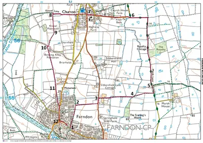
The route seemed reasonably dog-friendly. However, you will probably encounter a few cows, so you will have to keep a dog on a lead during those sections. You also walk along a busy main road for a minute and then through a village for about 10 minutes.
Starting Point
I started in the free public car park in Farndon. The address is Church Lane, Farndon CH3 6QD and the What3Words reference is what3words.com/gentlemen.wakes.spark.
From Wrexham city centre, take the A483 north for about a mile and leave at Junction 6, taking the A5156 slip signed for Gresford, Nantwich and the Wrexham Industrial Estate. At the junction/roundabout at the end of the slip, follow the A534 eastbound towards Holt. Continue along the A534 into and through the village of Holt. Cross the River Dee on Farndon Bridge (the old Holt Bridge), which takes you out of Wales and into Farndon, Cheshire. Carry on up into the village, where the road becomes High Street (B5130). Turn into Church Lane, near St Chad’s Church. Farndon Memorial Hall is on Church Lane (CH3 6QD).
Walk Directions
Farndon Frames
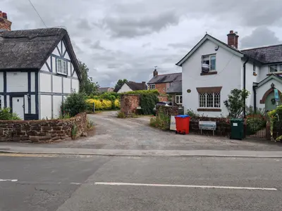
Turn left out of the car park and follow the road round to the left past the church on your right. Then, when you reach the end of Church Lane, cross over Barton Road and onto Walker’s Lane (1). You’ll see an advert for Farndon Frames just above it.
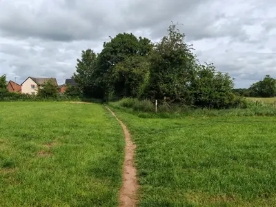
Continue along the narrow path between the gardens. Go through the wooden gate and onto the field. Once in the field, follow the left-hand hedgeline with the houses beyond and the beautiful views over to your right of what I suspect is the Sandstone Trail.
Go through the metal kissing gate after a few minutes, and carry straight on for about 100 yards. You’ll come to the angle of a fence and a signpost there that says you can either carry straight on to a metal kissing gate or turn right, which is what we’re going to do (2). Walk along the field with the fence, hedge and tree line on our left. You’ll be heading towards the Sandstone Trail in an easterly direction.
Sibberfield Lane Farm
After about five minutes, the fence, hedge, and tree line bend off to the left, but you just carry on in the same direction, heading towards the open gateway and the B5130 beyond. Turn left when you get onto the main road. Be careful because there’s no pavement or grass verge, so you are actually walking along the road surface for about a minute. Turn right following the public footpath sign into Sibbersfield Lane Farm (3). Walk down the drive, take a slight dog leg left and then carry on in the same direction towards the metal six-bar gates with the cow pen on your left.
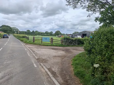
You’ll see a white public footpath waymarker arrow on the wooden gatepost as you head towards the second metal gate. Go through the metal gate and onto the concrete track beyond. Walk along the concrete track for about 15 minutes. You’ll come to a metal gateway with an oak tree on the left. You’ll see a sign on the left metal gatepost telling you to go left (4). You’re aiming for the far left-hand corner of the field you have just entered.
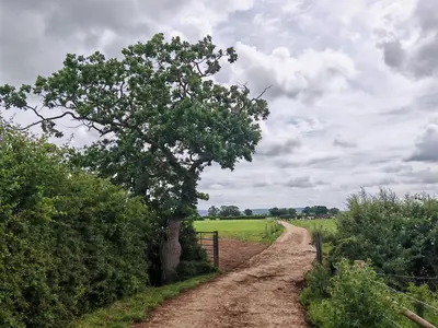
Yellow Insulating Handles
Unhook the yellow insulating handle from the electric fence on the left and step through. Re-hook it after you’re through. You’ll have to get there by walking around the electric fence that’s been put inside the field, so follow the left-hand hedge line for about 50 yards, then carry on in the same direction as this hedge line bends away from you to your left.
Walk in the same direction towards the gap in the hedge line ahead of you. Unhook another yellow insulating handle on your right. As you’re unhooking the second yellow insulated handle, you’ll be able to see the style that you use to exit this field dead ahead of you in the corner.
Walk over the very short wooden-planked bridge and hop over the stile into the next field. Follow the left-hand hedge and fence line, and exit the field through a wooden gate with a short wooden bridge beyond. Once through that wooden gate, you will turn left – not immediately left, but second left, so you’re walking down the right-hand side of the hedge that you see on your left as you go through the gate.
Marsh Lane
You should be walking along a narrowish track with a hedgerow on either side and tree branches spilling over and above you from the wood on your right. Walk along this old cart track and go through a metal walker’s gate with a footpath sign to its right.
Take the left fork and go through the metal rider’s gate with the long handle on the left, with the sign for the bridal track just to its right (5). This track actually has a name – it’s called Marsh Lane.
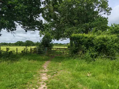
Go through another horse rider’s gate about 15 minutes later. The lever mechanism doesn’t seem to be working on that gate, so you’ll have to open it the old-fashioned way using the latch, which does work quite well. Just ahead, after opening the gate, you’ll see some fencing on your right that belongs to “Royalty House”.
“The Cottage”
Walk past an apiary on your right a minute or so later, and another lovely dwelling called “The Cottage”. We’re carrying straight on along what is now a vehicle track and has been since we passed the drive for Royalty House. Three or four minutes’ walk past the cottage, you’ll see a large wooden barn-like structure on your right. Up ahead, you’ll see some signs going left and right, and we’re going left.
We’re at the top right-hand corner of the walk now – the northeast corner of the walk. We just follow the bend around to the left as the rough, uneven track turns into a proper tarmac road. We’re following the sign for Bishop Bennett Way with the horseshoe on it. About five minutes after passing “The Barnyard’, we come to the end of Marsh Lane and join up with Edgeley Lane and Pump Lane.
Pump Lane and Churton
We’re turning left along Pump Lane (6).
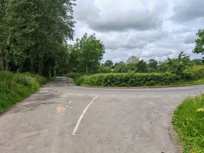
Again, take care because there’s no pavement or grass verge, but it’s a quiet country lane, so there shouldn’t be too much traffic. This road takes us into the charming village of Churton. You’ll come to a T-junction, where Pump Lane meets the B5130. Turn right and almost immediately left so you’re walking up to the right of Hobbs Cottage and the left of the White Horse Pub (7).
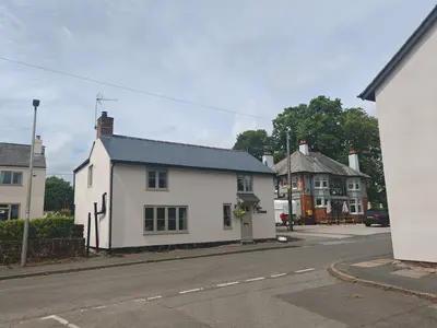
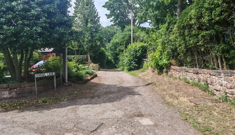
You’ll be walking down a narrow country lane called Hobb Lane. After about three minutes of passing the pub, you’ll come to a point where you can either turn right along Stannage Lane or you can walk on a few more paces and go left, again along Stannage Lane. We’re going straight on along Knowl Lane, down a gravel track past Knowl Cottage and Threave Cottage on our left.
Drover’s Trail?
This track has the classic look of a drover’s trail with its short bank on either side topped by hedgerows. Follow the track as it bends round to the right of the field with the mown middle section. You’ll come to a T-junction of paths, and here you want to turn left (8).
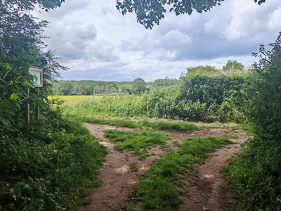
You’ll see a large wooded area away to your right. You’ll be walking along the edge of a field with a tall hedgerow running along to your left. Walk through a gap between two hedges after a minute or so. You’ll see a barn ahead of you and to your left.
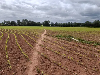
Walk along the field, following the distinctive straight middle section that acts as your initial path. It veers diagonally right after about 3-4 minutes by a white directional post that is now lying on the ground (9).
Ruddy Earth Track
Walk for another 3-4 minutes. You’ll see that you join another path (10).
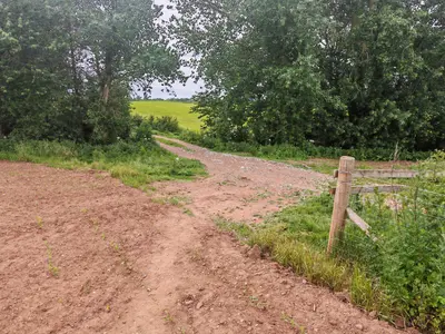
Turn left along this ruddy earth track with a high-ish fence hedge to your right and a very high hedge line to your left with a wooded area on the other side.
This track is almost dead straight for the first few hundred yards. You’re heading back south, so away to your right is the ridge that the sandstone trail runs along that we saw earlier on in the walk. You’ll see that you’re heading back into Farnham because you pass the Hideaway Cafe and Aptitude Health and Fitness on your left after about 10 minutes.
Go through a wooden kissing gate a couple of minutes further on. Four minutes further on, you’ll see the Barnston Memorial or “Farnham Needle” to your left (11).
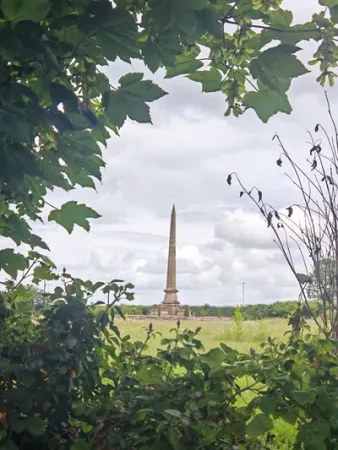
The earth path eventually turns into a gravel track called Brewery Lane as you reach the houses on the edge of Farnham.
Raven Hotel
You’ll come out onto the main road. Turn right, pass Swallow Fields on your left and continue towards the centre of the town. You’ll walk past the primary school. Turn left at the T-junction with the Raven Hotel just in front (12).
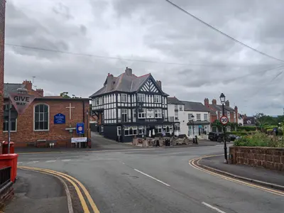
Carry on for another five or six minutes along the road until you can see the turn-off to your right for Church Lane and to your left for Walkers Lane. Go right down Church Lane and follow that round back to the car park where we started from.
Congratulations – you have finished the walk!
We hope you enjoyed reading “Discovering Churton and the North of Farndon”. Click here for more articles about your local countryside

