
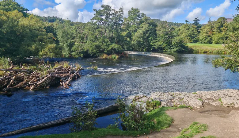
Falls, churches, a ruined abbey and lots of bracken! This month’s walk is a 5-mile circular near Llangollen.
Three impressive landmarks – the Horseshoe Falls, Llantysilio Parish Church and the ruins of Valle Crucis Abbey – turn this walk into something quite special. You’ll have some steep climbs as well and will have had your fill of bracken by the time you finish!
Before You Set Off
Distance and Climb
The walk is just over 5 miles, with a total ascent of 1,081 feet and a high point of 846 feet.
Getting There
From Wrexham, head for Llangollen and carry on along the A5 for two miles. Turn right onto the B5103 to get to the car park where I started. It costs £2.50 to park there.
Dogs and Stiles
There are sheep in almost every section of the walk, so you’ll have to keep your dog on a lead for long periods. You’ll also find a lot of stiles. Please read the walk disclaimer before you set off.
The Route
Horseshoe Falls Car Park
To start, come down to the bottom of the car park and go past the wooden post with the purple ‘Have You Paid and Displayed?’ sign. Follow that down to the road a few yards further down. Turn right when you get to the road and walk downhill. Go down the stone staircase just after the yellow grit bin (1).
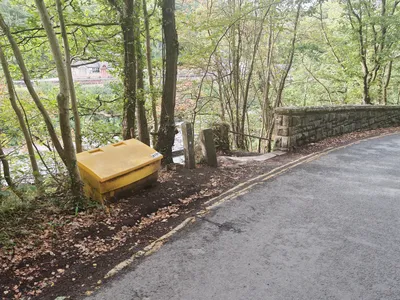
Take the bridge over the stream and go down the very short and steep metal steps – take care with those if it’s been raining – and turn right along the path. Go under the bridge and keep following the stream.
The path bends to the right as it crosses the stream again and goes past the left of the engine house. Carry on along the path, and you’ll see the Horseshoe Falls on the River Dee on your left. Walk past the ‘Private Fishing, Fly Only for Trout and Grayling’ sign and go through the old metal kissing gate ahead. Go through a second metal gate about 150 yards afterwards and walk over a short wooden bridge with a slight apex.
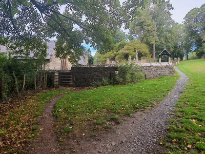
As you approach the church, take the right fork in the path so you’re walking to the right of the low stone wall, with Llantysilio Parish Church to your left (2). Walk up the steps, through the old metal kissing gate, and straight on up the church drive onto the road. Turn left and walk along the road for a couple of minutes. It’s a quiet road, but keep an eye out for traffic anyway.
You’ll come to a metal gate and stile on your right with a green metal footpath signpost. Hop over the stile and follow the path through the wooden gateway ahead. After about 200 yards, you’ll see a metal gate and stile on your left with a ‘Public Footpath This Way’ sign, pointing left. Hop over the stile next. You’ll see a farmstead with some outbuildings to its right. We’re going diagonally right across this field, passing under the telegraph cables to the left of the telegraph pole.
Red Letter Box
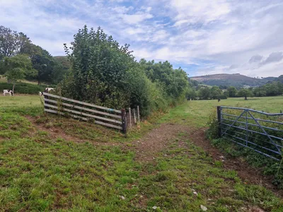
As you reach the wooden gateway, you’ll see a sign that says ‘Private – No Public Right of Way’. Here, walk to the left of the upwards-sloping fence and follow that fence and hedge line, which is now on your right (3). You’ll see a stile in the far right-hand corner, which you use to exit this field onto a lane.
Once you’re over the stile, turn left so you’re walking up the hill. After about three minutes, you’ll come out onto a main road. You’ll see a red letter box and a notice board for the village of Llantysilio. Turn right and right again up the wooden steps to the stile and into the next field.
Walk up the sloping field, and you’ll see a white arrow waymarker ahead of you, just before the fence and a wooded area. It tells you to make a right, which is what you do. Follow the path between the trees up to the right.
Just a note if you’re following this on your Ordnance Survey app: the public footpath actually goes through the wood itself. However, it looks like that has been amended, and what we’re doing is walking around its boundary.
Once you’re past the wood, keep heading in the same direction along the track trodden into the grass, towards the stile to the left of the two oak trees ahead. As you hop over the stile, follow the arrow on the waymarker post directing you left.
Gorse and Heather
You’re now walking along a path that traverses a slope, with heather and gorse up to your right and a barbed-wire-topped fence to your left. You’ll pass a television aerial and then climb over the stile after a few minutes. I’m afraid the step has disappeared, so you’ll have to climb over this stile using just the horizontal wooden bars.
You’ll find yourself in a coniferous wood. Continue following the same path you were on previously. The path gets quite narrow, but it’s still quite passable. Be careful, though, because you have to duck down under the canopy of trees and there are some loose stones underfoot.
There is a short stretch where the fence to your left disappears, but carry on in the same direction, and you’ll pick it up again after a minute or so. There’s a wooden stile about two or three minutes further on. The landscape above you changes to bracken and gorse.
A short distance further on, you’ll see a break in the bracken to your right. Turn right and almost back on yourself, so you’re heading up the path with the short waymarker post to the right (4). This part is easy to miss, so if you reach another stile that leads down to a lane a little further on, you’ve gone too far.
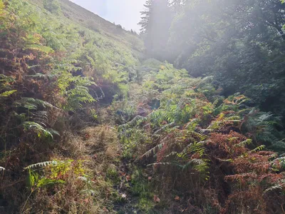
Go through the metal walkers’ gate by Townsend Supplies Limited of Denbigh, and continue up the track with bracken on either side. The path bends left as it rises. After about five minutes, turn 45 degrees to the right onto another path. This new path bends round to the right, straight down and then to the left.
Two Slate Walls
After a few minutes, you will go past a small rocky outcrop on your right (5). Follow the main path down, ignoring the first break in the bracken on the left. Turn left at the second break, so you’re joining a path that runs across you. This path looks like a sheep path, but it is actually a public footpath.
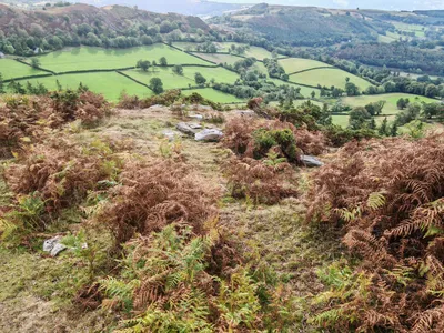
You should see a metal gate down to your right after a minute or so. Leave the open patch of ground and keep following the path as it goes into the bracken (6).
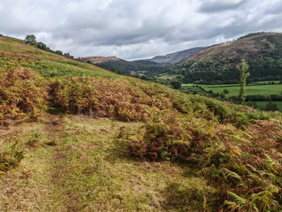
The bracken does brush your shins, but there’s a clear path through it. Before long, you’ll come to a wooden stile with a bleached white waymarker arrow. Hop over the stile and follow the path that runs along the fence line on your left. Walk around to the left of a crab apple tree and along a short section with a wooden railing to your right. Duck under the low-hanging tree over a tiny slate-bed stream.
The bracken gets in your way a bit for a short section, but the path underfoot is clear. Follow the fence to the left and pass the two slate walls on your right. The path has deteriorated a little in the following section, so pay attention to where you put your feet. After about seven or eight minutes, you’ll come to a stile on your right with a locked gate next to it. Hop over the stile and walk along the narrow downward path, with the coniferous hedge bordering the garden of the house to your left and the barbed-wire fence to your right.
** The concrete section is at a strange angle underfoot as you follow the hedge round to the left, and it could be slippery if it has rained.**
As you finish the path around the house, you’ll step onto the downward-sloping drive that descends to the main road.
Coed Hyddren
You come out next to the Britannia Inn. Turn right along the main road. However, you won’t be on it for long, and there are grass verges that you can step onto on the left and right. After about four minutes, turn down the lane on the right with the ‘Unsuitable for Large Vehicles’ sign. Take the stile on the left after about three to four minutes. You’ll see Coed Hyddren, or Velvet Hill, ahead of you.
Walk across the field in pretty much the same direction the stile step is pointing. Walk to the left of the telegraph pole, and then hop over the stile next to the metal gate. Head straight on towards the yellow bucket. Hop over the stile and remove the crocodile clip from the electric fence on your left (7). Duck under the single cable and replace the clip.
Walk along the narrow, muddy track between the electric cable on your right and a high, green hedge with holly on your left. Turn left when you see the blue hose pipe running along the ground, and take the stile in front of you onto a lane.
Turn right once you’re on the lane and walk past the red garage door on your left. After about three to four minutes, turn left just after the bench. Walk up to the fence on your right, hop over the stile and then turn left onto another path through bracken. Follow the path around to the right as you reach the satellite dish, and then follow the fence line around to the left. Continue along the path as it twists right and then left. You’ll be following a barbed-wire-topped fence and then some back garden fences on your left.
Valle Crucis Abbey
After the fences, follow the path down to the left. Hop over the stile and onto the road. The Abbey Grange pub is away to your left. Cross over the road and go up the drive towards Y Pandy. Walk through the gate and along the gravel drive to the left of the house. Hop over the stile with the yellow arrow waymarker and turn right, following the right-hand fence line. Cross the wooden bridge and climb the steep path up to the unique ladder stile (8).
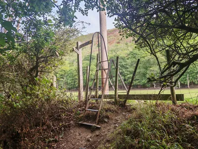
Turn right and follow the right-hand fence line along the flat fields for about 10 minutes. Turn right through the break in the fence by the sign saying ‘Abbey Farm Tea Room ¼ mile’. Descend the wooden steps cut into the bank and cross the wooden bridge. Walk straight on and step onto the road running through the campsite. Head straight on up to the lane. The ruined abbey is to your left. Turn left onto the lane and take a few minutes to explore the ruins (9).
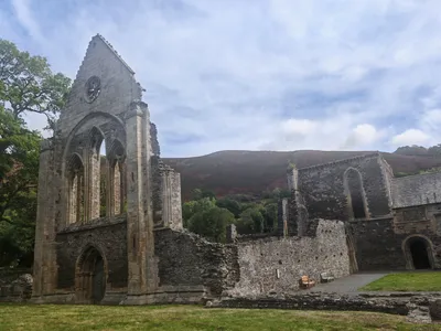
Turn left once back on the lane, walk under the barrier and go right through the kissing gate. Take a diagonal left after entering the field, so you’re aiming for the right of the walled estate in front of you. Go through another metal kissing gate onto the A542. Cross over onto the raised pathway on the other side of the road.
Turn left and walk for about 100 yards as far as the metal footpath sign on the right. Hop over the stile with the ‘Motorcycles Prohibited’ sign on the right, step up over the raised earth step and walk up the steep path for a few minutes. Turn left at the “T-junction of paths”.
Back to the Car Park
Follow the path across the slope over the exposed tree roots. Follow the barbed-wire-topped fence to your left for a minute or so before the path bends away from it to the right. Continue along the track with bracken on either side of you. You’ll be on this path for about 20 minutes in total. When you get to a bend with some exposed rock, you’ll know you’re not far from the stile you take to exit the woodland area.
Hop over the stile on your left with a yellow arrow waymarker on it saying ‘Llangollen History Trail’ (10). A sliding dog gate is just to the right of the stile.
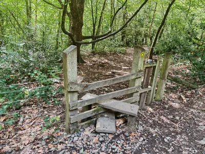
Head downhill using the wooden steps cut into the bank, cross the A542 again and then take the next turning on the left, following the sign that says ‘Corwen 8’. Walk down the lane and turn right at the wooden post with the purple sign on it and the ‘Llantysilio Green’ carving next to it. The car park is a few yards ahead.
Congratulations – you’ve finished the walk!
We hope you enjoyed reading about the Horseshoe Falls North Circular. Click here for more articles about countryside walks.

