

It’s always exciting to explore parts of our local landscape that feel tantalisingly close yet remain completely undiscovered. For this month’s route, we finally ventured out to explore Llanarmon DC, an incredible area just south of Glyn Ceiriog that holds some of the most dramatic, sweeping scenery our county has to offer.
The Pre-Amble: What to Expect
Before you lace up your boots, a quick heads-up: this route features some serious terrain. The first third of the walk contains some of the steepest uphill climbs I’ve ever had to tackle. To match, the final stretch before you return to Llanarmon village features one of the sharpest descents I’ve experienced – thankfully, there is a sturdy fence to hold onto as you make your way down!
The entire walk covers approximately 4.5 miles and should take 2½ to 3 hours to complete. Because of those steep gradients, you’ll cover nearly 920 feet (280 metres) of total ascent, reaching an impressive high point of over 1,500 feet (460 metres) above sea level. Your effort is well worth it, however, as the panoramic views are absolutely breathtaking throughout.
Dog-Friendly Note: The route is reasonably dog-friendly. However, you will be sharing a significant portion of the high open fields with hundreds of sheep. You must keep your dog on a lead at all times during these livestock-heavy sections.
Getting There and Starting Point
The walk starts in the historic heart of Llanarmon Dyffryn Ceiriog. I parked in the main village square directly opposite the entrance to the famous Hand Hotel, utilising the spaces next to the local bus shelter.
- Navigation Coordinates:
what3words.com/nosedive.soonest.strongly
There is alternative public parking available around the square. If you intend to use the dedicated hotel car parks, please pop into reception to ask permission and perhaps enjoy a pre- or post-walk refreshment!
Driving Directions from Wrexham:
- Head south out of Wrexham along the A483.
- At the Halton Roundabout, take the third exit onto the A5.
- At the next roundabout (Whitehurst Roundabout), take the first exit onto the A5070.
- Drive for roughly 1.4 miles, then turn right onto Castle Road just after passing the church on your left.
- After three-quarters of a mile, take the first exit at the mini-roundabout onto the B4500, keeping the canal on your left.
- Follow this scenic road for just under 6½ miles as it runs alongside the River Ceiriog, passing through the lovely hamlets of Pontfadog and Dolywern.
- Upon entering Glyn Ceiriog, continue to the centre and take the second exit at the mini-roundabout (straight ahead) onto Llanarmon Road.
- Drive for a final 4¾ miles until you arrive safely in Llanarmon. The bus shelter parking will be on your left as you enter the village square.
Step-by-Step Walk Directions
Phase 1: Out of the Square and Up the Ridge
From the village square, begin your walk by heading down the lane marked Llanrhaedr, located to the right-hand side of the Hand Hotel as you look directly at its front entrance.
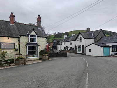
Pass the red telephone box on your left (1). Within a couple of minutes, look out for a green metal public footpath signpost on your right-hand side. To join the path, you will need to step up onto an elevated bank (2). It is a fairly large step, but you can safely use the small trees on either side of the gap to hoist yourself up.
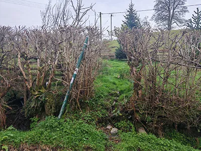
Once you are safely up on the raised bank, walk straight up the grassy slope ahead of you and hop over the two wooden stiles positioned in front. Immediately after climbing over the second stile, turn left and pass through a wooden gateway where you will spot a helpful yellow arrow waymarker on the left-hand post.
Drovers’ Trail
Continue forward, walking to the right of a solid, cylindrical orange plastic object resting on the ground (likely an agricultural livestock feeder). Head straight down the slope, passing a set of traditional sheep pens on your left, and hop over the stile located next to the metal gate at the bottom of the field (3).

Turn right here and walk a short distance up the old drovers’ trail. After about a minute, hop over the next stile (or pass straight through the adjacent gate). From this point, look up: you are aiming for the far top left-hand corner of the massive field ahead. There is no escaping it – this means some seriously steep climbing, no matter which line you choose to take!
Expect it to take a solid, breathing-intensive 15 minutes of continuous climbing to reach the stile in that top-left corner. You will likely be cursing my name on a few occasions during the ascent! However, as soon as you reach the stile, take a moment to look back over your shoulder. You will be happy that every ounce of effort was worth it for the spectacular, expansive views rolling across the vale surrounding Llanarmon.
Sheep, Sheep and More Sheep
Cross over this highly impressive, sturdy new stile and continue climbing the hill in the exact direction the stile steps are pointing. Aim directly for the mature oak tree visible on the skyline, tracking towards its topmost branches. When you reach the base of the oak tree, turn left and walk diagonally right down the slope towards an open metal gateway, which features a stile to its left-hand side. Go straight through this gateway and pick up the clear, historic vehicle track.
(Note: This next stretch is home to dozens of grazing sheep, so ensure your dog is securely on a lead.)
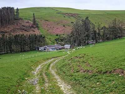
Follow the track through another gateway, crossing the small brook trickles. From here, head down towards the farm buildings of Cyrchynan-ucha directly ahead (4). Pass through the main metal gate and follow the clear, tarmacked private drive that safely guides you right through the middle of the farm property.
The High Bridle Track and Powys Borders
As you exit the farm boundaries, you will find yourself standing on a quiet rural lane called Crychynan Uchaf (5). Cross directly over the tarmac and head straight up the ascending vehicle track, which bends to the left and then sweeps round to the right.
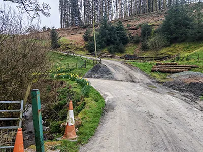
You’ll pass an old vintage plough on your right and a square red sign on your left reading “No cycling. Public footpath only.” Take the left fork at the top of this short slope. Follow the track further up the hill. Take another left fork after a few minutes, and begin following the left-hand fence line.
After about 7 to 8 minutes of walking, turn left through a wooden gateway (marked by another yellow arrow waymarker on the left post) and cross over a tiny stream bridge (6). Pass through another gateway a minute later, head over the stile directly ahead, and you will emerge back onto Llanrhaedr Road.
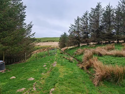
Geography Check: The official border with Powys lies directly ahead of you and is also just a five-minute walk to your right. If you look diagonally left (southeast), you are looking across towards the historic market town of Oswestry. The high-altitude, 360-degree views from this vantage point are genuinely spectacular.
Turn left along the road, and then turn right after just a few yards to pass through a dedicated riders’ gate. You have now joined a high-elevation bridle track that you will stay on for the next 1.7 miles (roughly 45 minutes of walking).
Navigating Gorse, Water, and Long Grass
Depending on the recent North Wales weather, this track can throw up a few watery obstacles! You will eventually encounter two large pools of water blocking the path, the first appearing after about 10 minutes on the bridle track. If you have waterproof boots, you can walk straight through and test your gear!
Alternatively, to keep your feet completely dry, exit the main track to your left just before the water begins and walk a few yards along the far side of the short fence section. This bypass leads to a crossing barbed-wire fence. Carefully climb over the specific part of this fence that joins the short section you’ve just walked along (7). While this spot doesn’t have a strand of barbed wire running along the absolute top bar, there is some attached nearby, so watch your hand placement closely.
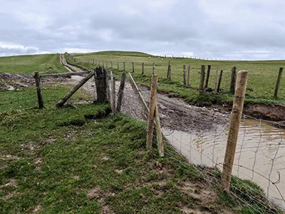
Continuing along the track, you will arrive at a large metal gate after about 25 minutes. This gate is difficult to unbolt and sags considerably under its own weight when opened. It is far too wobbly to safely climb over if you lack the strength to lift it back onto its latch. While you could attempt to climb the rusty gate forming part of the fence to the left, it is equally rickety.
Another option is to hop over the stile on the right. Walk along the edge of the fence line. Rejoin the track by scaling another gate further down – though, by sod’s law, this gate is also rather rickety! Take your time here, experiment safely, and choose the option you feel most stable with.
More Pools
Roughly 20 minutes further along the track, you will hit a second flooded section. To navigate this mud safely, use the wooden planks and logs laid out on the left side of the pool. Be cautious if you use the fence posts to steady your balance, as there is barbed wire running along them. The mud immediately to the right of the planks is incredibly soft and deep, so watch your step.
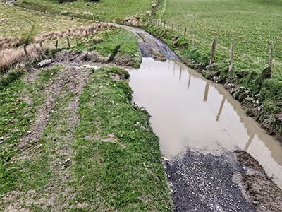
A minute or so later, turn off the main track by hopping over the stile on your left. Head down the slope. Keep to the right of the wild gorse bushes and long grass to avoid the waterlogged patches in this dip.
When you reach the far boundary fence, turn left and follow it on your right until you can safely exit the enclosure via a stile a short distance along. Walk directly downhill towards the beautiful block of woodland standing ahead of you. Head towards the left edge of the trees and pass through the metal gate in the fence line (9).
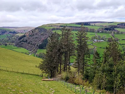
Continue to follow the right-hand fence line that borders the trees. Pass through the designated walkers’ gate further down the slope. Keep tracking the fence and the hedge line downhill. You will pass a white gate on your way – do not go through it – simply keep it to your right and continue straight down along the main fence line.
While map routes indicate a public footpath branching off to the right here, I couldn’t find it. Stick to the reliable line: continue in the same direction, tracking the right-hand fence and passing through an old wooden gate.
St Garmon’s Church
Word of Warning: This is where the descent turns exceptionally steep! Use the sturdy fence line running along your right-hand side to steady your weight and pace yourself. Do not be tempted by the steps visible to the left at the bottom of the field; that side of the field is simply too steep to descend safely.
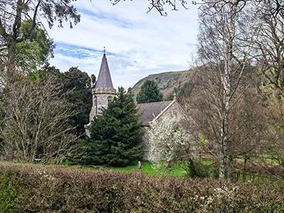
At the very bottom of the hill, exit the field through the final metal gate. Turn left onto the tarmac lane. You will pass the historic, peaceful site of St Garmon’s Church on your right (10) after a few minutes. A minute later, you will find yourself back in the village square where you started.
Congratulations – you’ve conquered the hills – up and down – and finished the walk! Now, it’s time to treat yourself to a well-earned drink or a roaring fire at the Hand Hotel or the West Arms.
We hope you enjoyed reading “Up Hill and Down Dale Around Llanarmon DC: A Dramatic 4.5-Mile Circular Walk”. Follow this link for more articles about local walks.

