
We’re back in Cefn-y-Bedd for the starting point of this walk. The last one we started there took us west towards Ffrith, but this time we’re heading east in the direction of Llay. There are stunning views at every turn, coupled with the odd surprise as always.
I stuck with a slightly shorter route again this time, so you’ll cover about 3¾ miles and make a total ascent of 427 feet (130 metres), with the highest point being 467 feet (142 metres).
“Pre-Amble”
This walk was very straightforward compared to the difficulties I had with the previous month’s walk around the north of Pen-y-Cae. You have to walk along the busy B5373 between Llay and Caergwrle for a quarter of a mile, but that’s the only real inconvenience apart from a short stretch of path that’s a little overgrown. The quarter-mile stretch has a verge you can walk along by the way. There are a couple of paths that are a little overgrown.
Starting Point
I started off in the car park of the Holly Bush in Cefn-y-Bedd. Please pop in for a drink or a bite to eat if you park there. It’s easy to find. If you’re coming from Wrexham, hop on the Mold Road (A541) at junction 5 of the A483. Follow it for about three miles. Turn right just before the railway bridge onto Llay Road B5102. You’ll see the pub on your right, and the car park is just beyond.
Pub address is Llay Rd, Cefn-y-bedd LL12 9UD (what3words.com//mixed.lushly.handlebar).
Disclaimer
Important: Your safety is our top priority. Before attempting any of our walks, you must read and understand the disclaimer at love-wrexham.com/walk-disclaimer.
Always remember to read ahead of your current position in the walk directions in case we mention an upcoming potential hazard.
Walk Directions
Holly Bush, Cefn-y-Bedd
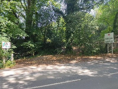
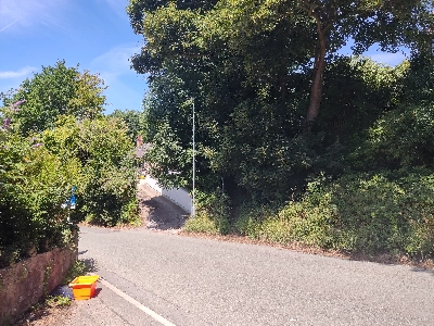
Turn right out of the pub car park onto Llay Road. Walk down into the dip and up the other side before turning left onto the track. Turn left in between the Flintshire and Wrexham border signs (1).
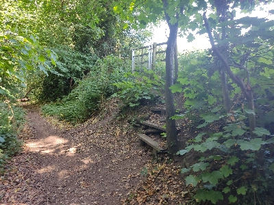
Walk along the woodland path with the River Alyn to your left for about a quarter of a mile or five or so minutes. You’ll see a metal kissing gate above you and to your right. Walk up the wooden steps cut into the bank and go through the gate into a field (2).
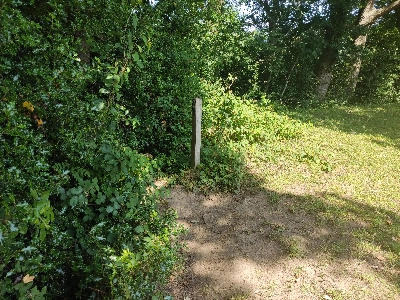
You’ll see a mobile phone mast at the top of the slope ahead of you. Turn left and follow the treeline on your left. Exit the field through the metal kissing gate ahead. Cross the short concrete bridge with the metal handrails into the next field. Head more or straight on, aiming for the right of the house you can see ahead of you. Exit the field through the metal gate, walk up the bank and turn sharp left back into the woodland, following the yellow waymarker arrow on the wooden post (3).
Follow the path around as it bends to the right, through a metal, and over a short wooden bridge. You’ll then walk along a path that runs along the right of the property (Little Rhyddyn Farm) you saw previously. Walk up the narrow gravel path with the fencing of the house to your left.
Wat’s Dyke
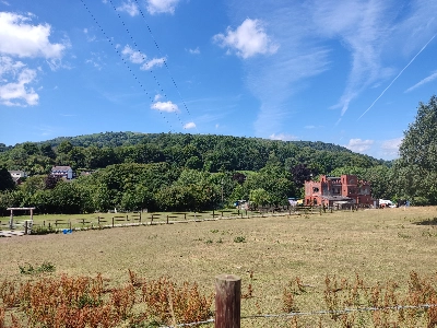
The path takes on the aspect of a drover’s trail. You’ll walk past an opening on your right that was home to a tiny but very yappy dog. The views of Hope Mountain to your left are truly spectacular. You’ll also pass a very distinctive Ruabon red brick castle-like building on your left (4).
Wat’s Dyke path also runs along your left. Cross the lane just ahead and take the path slightly to the left, not the stone steps directly in front (5).
Hop over the wooden stile almost immediately. Follow the narrow path with the houses further up the slope to your right. You’ll walk between two wooden fences and then hop over a stile. The path levels out and then begins to descend slightly. Follow the path as it bends around the large white house on the right. You’ll pass a yellow arrow waymarker post. Turn sharp right at the T-junction of paths. Go through the wooden gate and follow the narrow path with the woodland to your right.
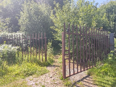
You’re now on the Wales Link Path or Llwbyr Cyswllt Cymru. Make sure to look left for more amazing views. After about 12 minutes, cross the wooden duckboards with the metal mesh over them. Go through a wooden kissing gate and turn almost 45° to your right before the concrete blocks so you go through the rusty metal gates (6).
Jordan!
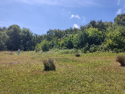
You’re off the recognised footpaths on the OS map now, and I only found those courtesy of local resident Jordan, who was my guide for the next 20 minutes. Continue straight ahead along what appears to have been a concrete path, now almost entirely covered with grass. After about two minutes, turn left up the slope at the section where the grass has not covered the concrete.
Turn right after a few yards at the fork and follow the path up towards the line of trees that runs across in front of you. Turn around and enjoy yet another brilliant view towards Frodsham. Turn back around and scan the tree line in front of you. Walk through the gap slightly ahead of you and to the left, which has a group of silver birch trees (7).
Turn left at the T-junction of paths after a minute or so. Pass the two chairs and the table on your right. A couple of minutes after passing the chairs and the tables, turn right at another T-junction of paths, walk past the large stone bollard and down the drive to the road which runs through the tiny village of Rhyddyn Hill.
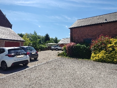
Turn right onto the road and then left after about a minute down the bridalway with the signs for Caer Estyn Farm and Mountain View Farm. Turn left after about five minutes, just before Caer Estyn House. You’ll walk into a farmyard. Go through the gate to the right of the corrugated green metal barn and then hop over the wooden stile.
Rackery Lane
Walk straight on and go over another stile almost straightaway. Head across the field and aim for the stile about 150 yards to the left of the metal gate in the fence and hedge line ahead of you. You’ll find yourself in quite an overgrown field, but somebody has very thoughtfully mown a path around the perimeter, so turn right and follow the mown path around the field until you’re on the far side.
As you make your second left following the mown strip, exit the field using the stile on your right. The stile is very wobbly, so be careful as you negotiate it. The following path is quite overgrown and leads you up to Rackery Lane (B5373). Turn right and walk along the busy road for about a quarter of a mile. There is a grass verge along the right-hand side, so you won’t have to step out onto the road.
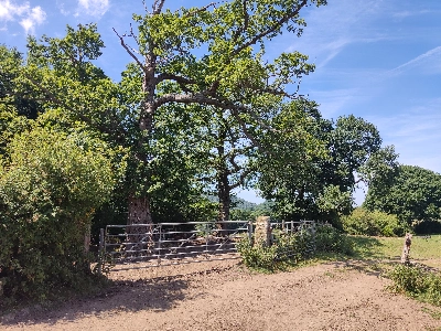
Walk past the sign telling you you’re back in Wrexham. Turn right shortly after the sign into Rackery Hall Mews. Walk down the drive and to the left of the house in front of you. Go along the short drive with the greenhouse (half brick, half glass) to the left and take the metal gate built into the larger gate in front of you (8).
Walk across the lawn, following the left-hand fence line and hop over the stile by the mini-statue of the man with the shotgun and the HMS Preston lifebelt. Walk over the slate-covered bridge, through the metal kissing gate and into the next field.
Hope Mountain
Head slightly diagonally left across the field. Hope Mountain is in front of you now. Aim for the post in the far hedge line, with a telecommunications tower on the horizon beyond. As you get closer, you’ll see that you can take a stile or go through an open gateway to exit the field.
Head straight across this next field. You probably won’t be able to see the yellow-topped post of the stile until you get closer to the far tree and fence line. The stile is in the angle of the hedge and fence line ahead as it turns 90° towards you. This stile is in poor condition and extremely rickety (9).
It doesn’t have anything to hold onto either, so you’ll need a companion to steady you as you cross it. If you’re alone, take your time and make sure you’ve got a proper foothold before swinging your leg over to the other side.
Once over, look at the far tree line ahead of you. You should see a gap immediately to the left of a large oak tree. If you’re unsure, follow the right-hand fence and tree line to the corner of the field. The gap is a little to your left when you reach the corner.
Popping Gorse
Head diagonally left once through the gap, aiming for the opposite corner. It’s heavy going here through the longish grass. As you get closer to the corner, you’ll see a gate with a ladder stile to the right. There was some orange plastic rope tied across the top of the stile, so I climbed over the gate instead.
The views of Hope Mountain are pretty jaw-dropping here! If it’s a really hot day, you’ll hear the gorse behind you and to your right popping here.
Follow the left-hand hedge line. Walk through the open gateway or the slightly battered metal walker’s gate. Follow the right-hand hedge line in this next field. Go through the large metal gate and then immediately left through the metal walker’s gate (10).
Walk past the green, corrugated metal barn on your left. The field slopes down as it gets narrower and then opens out to the right as you reach the bottom of the slope. The stile to exit this field is in front of you through a gap, but is hidden behind the hedgerow. If you can’t find it, locate the telegraph pole and run your eye right until you see the second gap. Hop over the stile and walk down the steepish slope to rejoin Llay Road. Turn right and head back up to the Holly Bush pub.
Congratulations! You’ve completed the walk!
We hope you enjoyed reading “Cefn-y-Bedd Circular Walk”. Click here for more of our walk features.
