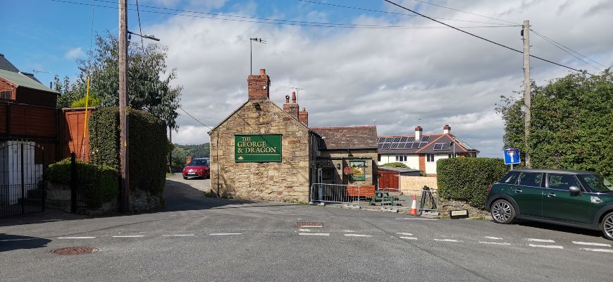
This five-mile walk starts and finishes at the George and Dragon pub (Ael-Y-Bryn, LL11 5DA; grid ref SJ 294541) in Brymbo. There are some excellent panoramic views of Wrexham and the Cheshire Plain along the way.
The route descends through picturesque wooded valleys and crosses open farmland, passing many of the features from the area’s industrial past. The mix of habitats allows the walker to experience something new throughout the seasons.
Disclaimer
Our walks follow public footpaths as indicated on OS maps wherever possible.
You must read, understand and accept our disclaimer before you attempt any of our walks.
Starting Point
From Wrexham town centre, take the A525 towards Ruthin. After crossing the junction with the A483, take the second right after about 30 seconds (Heritage Way). Follow the road uphill. Go past the Brymbo Sports and Social Club on your right and the village of Tan-Y-Fron on your left.
Go straight over the first two roundabouts. Take the first exit off the third one and continue past the remains of Brymbo Steelworks on your left. Turn right at the T-junction and then left by the chemists onto Ael-Y-Bryn.
There is a small car park opposite the school on the road to the pub. You will be able to see the George and Dragon uphill and across from the car park entrance.
The number 12 and 13 buses link Brymbo with Wrexham. Bus information is available at 01978 266166 or Traveline Cymru on 0800 464 0000, text 84268 or at traveline.info.
Other Information
Ordnance Survey Explorer Map 256 covers the area. This map is available for £8.99 from shop.ordnancesurvey.co.uk.
This walk may be muddy and slippery in some places so please wear suitable footwear and take extra caution. We also recommend long trousers or gaiters as you will be walking through long grass and thistles at times.
This route is not suitable for wheelchairs or buggies.
Walk Directions
Stand with your back to the George and Dragon pub (1) and walk up the road to your right. This is Pen y Graig Road. Pass the “Poppy Field” cul-de-sac to your right. As you walk uphill along the road, you will pass the Rocko (2) on your left, a sculpture commemorating Brymbo’s recent industrial past.
You can stop here and look behind you at the stunning views over the Cheshire Plain (see main image).
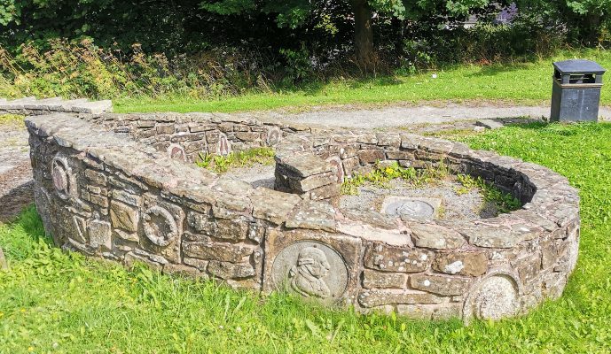
The path to the sculpture has stone seats with insets bearing the names of families who worked at the steelworks in the past. There is also a separate stone with a relief portrait bust of John Wilkinson, the local ironmaster. The sculptor worked with the community and consulted with local people to produce a work that reflected the industrial heritage.
The design for the sculpture was based on images of the old steelworks that former workers suggested, the hot steel, the huge scale of the machinery and the intense heat.
Brake Road Oak Tree
As you carry on along Pen y Graig Road, have a look at the different ornate chimney pots on the houses. You will come to a crossroads. Ahead of you, to the left of the magnificent oak tree is Brake Road. The oak (3) is one of our longest living trees, spanning many generations.
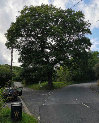
Walk uphill along this tree-lined country lane. As it bends to the left by the stone cottages and the yellow grit box, take Waterside Way on the right. You will see a stile in front of you next to a large field gate after a minute or so. Cross this stile and go straight ahead through the gorse bushes and carry on along the track.
Brymbo Pool
In the winter, you will see Brymbo Pool to your right across the field. Brymbo Pool (4) was once a natural lake of three acres. It was enlarged to five acres in 1892 and to eight acres in 1958. The pool provided a constant source of water for the steelworks.
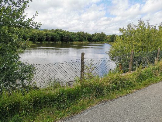
Following the closure of the works, the pumps used to fill the pool were decommissioned. This action together with leaks in the pool bed resulted in a dramatic fall in water levels. In 1996, remedial work was undertaken to seal the pool bed with clay, therefore preventing further leakage. The current area of Brymbo Pool is around three acres again.
Carry on along this track. Turn right at the overgrown remains of a hedgerow. You will also see a waymarker with a yellow symbol.
Bottle Chimney
As you approach the large stone structure, follow the slightly overgrown path to the left towards the corner of the field. This building is a bottle chimney (5) built between 1792 and 1794 dating back to John Wilkinson’s era.
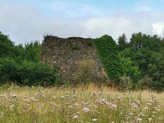
It was one of his earliest industrial undertakings in the area and formed part of his nearby lead-smelting plant. The chimney once stood over 100 feet (32 metres) high before being partly demolished in 1962, leaving the current 25 feet (8 metres) tall.
Cross the ladder-style stile in the corner of the field, bear left and follow the track downhill through the mature large holly trees. After a couple of minutes, you will see a large house in front of you. This is Hurricane House (6), a private residence that stands next to the former site of Wilkinson’s lead works.
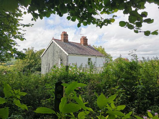
With the house on your right, pass through the field gate and bear left towards Minera Road. Carefully walk along Minera Road for approximately 50 metres until you see a stile in the hedgerow on your right (look out for the dotted line on the right-hand side of the road).
Minera Mineral Railway
Cross the stile and head downhill across the field keeping the hedge to your left. As you cross the two stiles next to the field gates you will notice a track running across you between two parallel hedgerows.
These tracks mark the route of the Minera Mineral Railway track (7) which served Brymbo’s Ironworks with lime, ore and coal from the nearby Pen y Coed Colliery. Keep the hedgerow to your left again as you walk downhill across the next field.
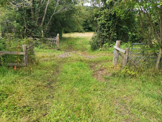
Go through the metal gate in the left-hand corner and descend into the wooded dip. Ahead of you, there is a stone bridge crossing this enchanting steep-sided valley. Cross the bridge and the nearby stile ahead of you before returning to open farmland.
With the beech wood and hedgerow on your left, continue uphill towards the next stile. You can turn round and look back towards Hurricane House here, and look left down the wooded valley.
Cefn Farm
After crossing the stile, walk uphill across the field diagonally towards the top right-hand corner. Cross the stile by the green and red metal gateposts (see image below). Keep the hedgerow on your right, before crossing another stile to your right. Head along the track that dips in front of you.
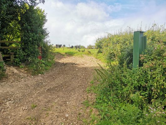
You will cross next to a babbling brook before walking uphill into the next field. Cross the field diagonally with Cefn Farm on your right, heading towards the field gate. After walking through the gate, keep the hedge to your right and walk towards the stile in the corner of the field.
Cross the stile onto Cefn Road and directly opposite you will see another one (partly overgrown). Climb over that and head downhill to the stile in the bottom left-hand corner of the field. After crossing the stile there, head over the next one nearby on your right and head uphill towards the farm buildings. This is Waen Farm.
Bwlchgwyn
Go through the two field gates and immediately turn left towards another one that leads back into a field. Go through there, keep the fence on your right and walk onwards to the next field gate. With the fence and wooded area on your right, walk towards the stile in the corner of the field. Cross over and head along the path back towards Cefn Road. Turn right and walk along the lane into the village of Bwlchgwyn.
At a height of 1,090 feet (333 metres) above sea level, Bwlchgwyn is one of several places claiming to be the highest village in Wales. The name translates as “White Pass” in Welsh. The area is well known for its snow during winter and this may be the reason. Another explanation is that it refers to the white limestone cliffs nearby. It has also been suggested that the original name was Bwlchgwynt meaning “Windy Pass”.
Ignore the footpath to your right and carry on along the lane towards the school. As you approach the school and before the road junction, turn right and walk along the path to the left of the house. Cross over the track and continue along the path. When you reach the house, turn left and walk along the gravel driveway to the road. This is the A525 Wrexham to Ruthin road.
Bwlchgwyn War Memorial

Turn right and walk along the pavement towards the War Memorial (9) which is located in the lay-by on the bend in the road as it bears to the left. The memorial was erected in memory of the 12 local people who lost their lives during the First World War, and the two people who died during the Second World War.
This is a lovely spot to rest and look at the panoramic views over Wrexham and eastwards towards the Cheshire Plain. You can also look westwards towards the dramatic expanse of the moorland landscape. The memorial is also the starting point for a five-mile walk around Nant y Ffrith featured in our January 2020 edition.
Take the lane to the right of the War Memorial. This is Glascoed Road. Follow this lane for about a mile, passing a stone quarry to your left in Coed Mawr and the two lanes on your left, you will see a junction on your right. Take this right-hand lane, this is Cefn Road again.
Cefn Road (8) follows the line of a main Roman route that passed through here from the village of Ffrith. It goes to the top of Brymbo Road and then over to the old Ruthin road which traverses the Llandegla moors.
Ghosts of a Roman Army!
In 1602, the ghosts of a Roman army were reported marching through the area! Walk along here until the lane dips as it crosses a stream. Cross over the stile to your left. Keep to the right-hand side of the field and head towards the corner. Climb over the next three stiles keeping the trees to your right as you walk through the open farmland.
Cross the stile and descend into the woodland. After walking down the wood steps turn left. Cross over the small boardwalk and head towards the lane. Turn left and walk uphill. As the lane bears to the left, follow the footpath ahead along the track and turn right off the track into the woodland.
Head downhill through the woodland, descending two sets of wooden steps before crossing the stream and walking uphill to your left. Ignore the right and left paths and carry on up the valley slope. Cross the stile into open farmland. Ignore the stile directly opposite and instead head towards the top left-hand corner of the field.
Minera Road
This meadow is a riot of wildflowers in the summer. Climb over the stile onto Minera Road. Take care as you turn left and walk downhill towards the stile on your right. Cross the stile and walk straight across the field and another two stiles. As you head from the stile, you will see a muddy track to your left, head towards this, and walk along the path keeping the track to your left.
When you reach the stile cross over it onto a gravel track. Turn right. On your left, you will see the remains of the Minera Mineral Railway (7) track once again. Walk up the gravel track back towards your starting point. As you reach the brow of the hill you will see the George and Dragon pub in front of you. You have reached the end of your walk.
Follow the Countryside Code
RESPECT – PROTECT – ENJOY
Be safe – plan ahead and follow any signs. Leave gates and property as you find them. Protect plants and animals and take your litter home. Keep dogs under close control. Consider other people.
Please report any problems to rightsofway@wrexham.gov.uk or 01978 292 057.
Many thanks to Wrexham County Borough Council for supplying us with this walk. Please visit wrexham.gov.uk and look for ‘self-guided walks’.
We hope you enjoyed “Circular Walk Around Brymbo And Bwlchgywn“. For more of our features on local walks, please click here.

