
We journey to another far-flung corner of Wrexham this month to tackle one of the most south-easterly points of the county between Hanmer and the Shropshire border.
We also revisit a small part of the walk we featured in our July 2022 edition around Fenn’s Moss. With many stretches of sandy soil, which according to one farmer I met, sat on large patches of peat, the going underfoot was relatively firm, especially in comparison to last month, which was incredibly wet.
However, I did also encounter some areas of thick, clay mud which stuck to my boots and made for some hard going at times. There was plenty of variety on the walk. It was reasonably flat but with noticeable changes of scenery as you went from country lanes, across rolling meadows and along narrow, thickly vegetated paths.
Starting Point
I parked in the car park in front of Hanmer Church. I also noticed a few places near the beginning of the route that could serve as parking spaces. The Hanmer Arms has a car park, but you must ask permission before leaving your vehicle there for the day.
The Hanmer Church postcode is SY13 3DE and its WhatThreeWord location is what3words.com/animate.sadly.commoners Hanmer is just off the A539 between Penley and Whitchurch. Two roads off the A539 take you into the village, and both end up close by the church after a few minutes.
The total ascent is just over 360 feet or 110 metres, with the highest point being 340 feet or 104 metres. The map is available online at explore.osmaps.com/route/20296898 if you have an OS Map subscription.
Overview
The walk is reasonably dog friendly, although you do pass through areas of horses, sheep and cows. Field exits were noticeably mainly gates with only a few stiles. It is about 7 1/2 miles long and should take about 3 1/2 hours.
Important: You must read and understand the disclaimer on our website before attempting any of our walks: love-wrexham.com/walk-disclaimer.
Walk Directions
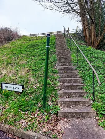
Striga Bank
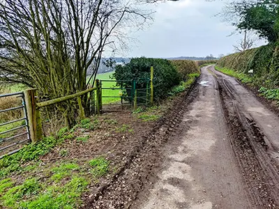
Stand with your back to the church entrance and turn left. Walk a few yards and take the road to the right, passing the north end of the mere on your right. This road has no pavement, so take care as you walk up it for a couple of minutes before taking the concrete steps (1) on the left next to the sign for Striga Bank (you’ll see a green metal footpath sign for the “Llwybr-Maelor Way”).
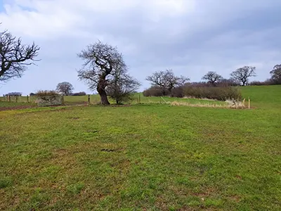
Enter a field through the metal kissing gate at the top of the steps. Walk across the field and exit using the metal gate in the hedge/fence line opposite. In this field, walk between the telegraph pole and the old oak tree by the pond.
Exit using the metal gate in the far hedge line. Walk straight across the next field and exit using the metal gate to the left of an oak tree. Use the single wooden railway sleeper to walk across the ditch on the other side of the gate. Carry on in the same direction towards the white house.
Use the metal gate in the left-hand fence/ hedge line to exit this field. Head for the fence/hedge line in front of you and exit the field through the metal gate.
Cross the lane and enter the field through the metal kissing gate to the right of the dual metal cattle gates. Walk between the left-hand hedge/fence line and the thicket of trees surrounding the pond. Carry on along the left-hand hedge/fence line as the field starts to rise. After you reach the brow of the hill, walk down the other side and exit the field through the metal gates at either end of the short wooden bridge.
Llywbr Maelor Way
Continue in the same direction after you go through the second metal gate. Head for the line of trees that runs across you in the middle distance. Move over to the right-hand corner as you get closer to the far hedge/fence.
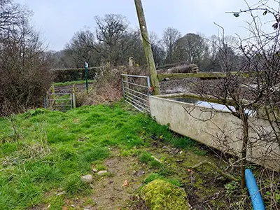
You’ll see a stile at the bottom of a short slope just after the concrete water butt and the short length of corrugated blue pipe (2). Hop over the stile and turn right on the earth track. Walk along this track for five minutes, ignoring the path left for the Llywbr Maelor way.
Leave the track as it turns 45° left. Go through a metal cattle gate, unhook the blue insulated handle on the electric fence to your right, and hop over the extended wooden stile a few yards further on across the corn field. Turn left and walk along the path, passing an oak and holly tree that have grown together.
The public footpath takes you straight on here, traversing the top of a bank, but you’ll have to duck, dodge and climb to negotiate some low tree branches. I suppose it’s reasonable to suggest you can avoid this by dropping to the bottom of the bank and using that route to bypass the trees.
The path eventually levels out at a patch of grass. You’ll see a hedge running across in front of you with a gap in it and a dilapidated metal gate on your left. Turn right here and you should see a wooden post with a yellow waymarker on it.
Dense Vegetation
You have to stray slightly from the public footpath here to avoid a patch of seriously muddy field, but the farm owner (George) was OK with walkers doing this.
Head straight downhill towards the grassy bridge and metal gate. Turn left just before it. Hug the right-hand fence line with the brook and dense vegetation just beyond. Walk towards the farm, sticking to this right-hand fence line to avoid some of the boggy bits in the field.
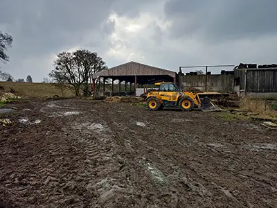
Walk to the right of the red farm trailer and unhook the blue plastic insulating handle from the electric fence (3). Turn left and repeat. Turn right and walk past the barn on the concrete standing, which is now on your right. Turn right at the end of the barn and then left so you walk past the front of the farmhouse.
Walk along the drive up to the A495. Turn left and walk along the grass verge. Cross the road when you reach Smithy Farm and turn right 100 yards afterwards at the green, metal bridleway marker.
Red Brick Outbuilding
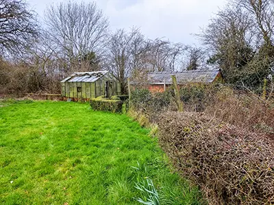
Walk up the drive with the grassy middle section and pass the red brick cottage on your left and a pond, a small red brick outbuilding, and a greenhouse on your right (4). Carry on along the path for about five minutes.
At one point, this path is quite overgrown with brambles, but it is still passable. Go through the metal walker’s gate with the long vertical lever and walk along the left-hand hedge/fence line for about five minutes.
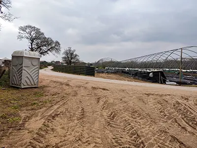
Exit the field through another metal walker’s gate. Follow the left-hand hedge/fence line until you reach the portaloos and tunnel house area of the Maelor Forest Nursery (5). Join the concrete track that runs across you and carry straight on until you reach the car park on the right.
Walk to the left of the two electric vehicle charging posts until you reach the post with the yellow waymarker arrow next to the two wooden field gates.
Go through the gates and turn left so the nursery buildings are on your left and follow the left-hand fence/hedge line. At the end of the hedge line, turn left and go through a gateway. Turn right and go through another one. Follow the path straight on (the one furthest to the right of the three paths) so you’re hugging the right-hand fence/hedge line.
Old Tyres
You’ll see an area full of old tyres and agricultural machinery to your left. When you pass that area, walk left across the field (it had some baby conifers planted in it). Aim for the metal gate in the middle section of the far hedge/fence line. Take the wooden bridge over the brook.
Strangely, there was an upright roll of fencing blocking the exit to the bridge. It was quite easy to move out of the way and I was able to continue without any problem. I suppose the farmer had put it there to prevent livestock getting onto the bridge, but that’s just a guess. The bridge is definitely on a public footpath, as you can see when you walk through the metal gate before the bridge.
Anyway, cross the field diagonally to the left and exit it over the cattle gate in the far-left corner. Head diagonally right in the next field, passing a massive oak tree. Exit the field to the right of the part where the fence curves round some trees surrounding a pond. Turn right on the lane and walk a few yards to the right.
Turn left down the bank and through the brand new metal gate. Follow the barbed wire to your left into the wooded area between the pond on your right and the brook on your left. Head diagonally right when you reach the open field. You are now on a stretch we previously covered in July 2022 as part of the walk along the Shropshire Union Canal and Fenn’s Moss.
Taraloka
Hop over the stile onto a narrow lane; the women’s Buddhist retreat called Taraloka is on your left. Turn right and walk until you reach the metal kissing gate on your right after a couple of minutes. Go through the gate into the field and turn left. Hop over the double stile to the left of the bridge.
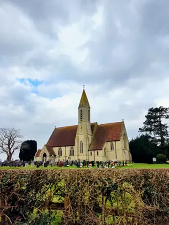
Go up the slope and turn right along the road, crossing the old railway bridge. You’re now in the hamlet of Bettisfield. Make sure you look left to the old station platform that Peter and Christine have lovingly restored. Dominating the area, however, is the large and very impressive church (6). Turn left along the lane with the derestricted signs before you reach the church. After a minute or so, hop over the cattle gates on the left. Walk along the lefthand edge of the fence line in front of you for about a quarter of an hour.
When you walk past the “lightning tree” on your left, walk through the gap between the gates into another field. Head diagonally left in this next field, aiming for the stile at the mid-point of the far hedge/fence line, just to the right of two very large oak trees. Head diagonally left again once over the stile. Exit the field through the two metal gates by the public footpath sign. Turn right on the lane and walk along it until you reach the main road – the A495 again.
Old Hall Farm
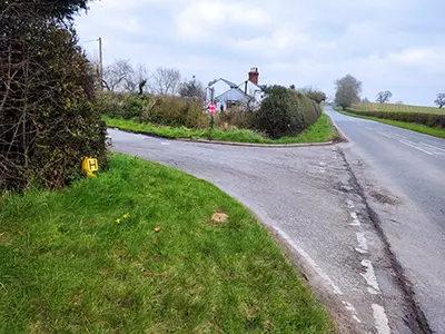
Turn right and walk along this road for a few yards before turning left just before the white house (7). Walk down the lane for a few minutes and take the narrow lane on the right, just before Old Hall Farm on the left. Leave the path when it becomes gravel and bends to the right.
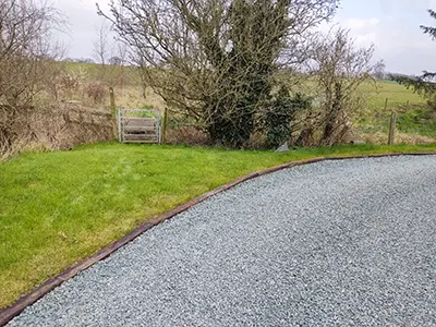
Go straight on through the metal gate and over the short wooden bridge with metal mesh on top (8). Turn slightly right and go through the brand new metal kissing gate. Walk between the two telegraph poles in the next field. Exit the field through the metal walker’s gate ahead of you. Follow the left-hand hedge/fence line in the next field. Exit by climbing over the metal gate towards the far left-hand corner.
Walk a few paces in the next field and go through the metal gate on the left hedge/fence line. Turn right and follow the righthand hedge/fence line in the next field. After a few minutes, the field you’re in narrows as you reach another field on your left. Go through the gateway to the left of the oak tree. The gate is held onto the post by some turquoise rope (9). Follow the right-hand fence/hedge line for a few yards and then walk to the left of the large, fenced-in thicket of trees ahead of you. When you reach the brow of the hill, head down the other side and exit the field over the stile in the far left-hand corner.
Yellow Waymarker Arrow
In the next field, follow the righthand hedge and fence line. Exit the field by using the walker’s gate in the far hedge/fence line. Turn slightly diagonally right in the next field and walk up the slope and down the other side. Climb over the extended stile to drop into the next field. Walk down the gentle slope, following the fence line to your left. Follow the yellow waymarker arrow. You’ll come to a wooden stile in the fence line with another wooden stile just over the next stretch of field beyond.
Cross the two stiles and walk up the slope with the fence and woodland to your right. Follow the right-hand fence and woodland on your right. Go through the metal walker’s gate. Follow the right-hand hedge and tree line until you reach the cattle gate. Go through that into the next field and follow the righthand hedge line until you reach a metal gate just past the house on your right. Go through the metal walker’s gate onto a drive and turn left. Walk a few minutes until you reach the green metal kissing gate on your left (10).
Head down the slope towards the mere and go through another green metal kissing gate at the bottom of the slope. Walk along the edge of the mere to your left. Go through another couple of green metal kissing gates. You’ll find yourself on a path through a wooded area. Continue along the path until you reach the road. Turn left to get back to the church.
Congratulations! You have finished the walk! If you’d like to see some more of our walks, click here.
