
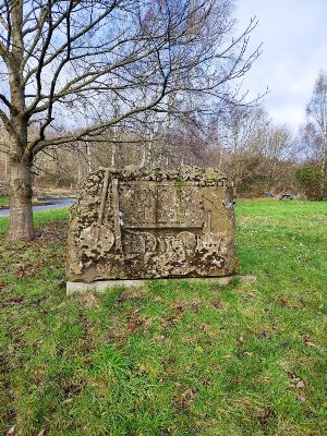
We’re a bit more central this month as we tackle a seven mile circular walk to the east of the Bonc-yr-Hafod Country Park near Pentre Bychan and Johnstown.
The going underfoot was very similar to a couple of months ago when we walked round Worthenbury, i.e., waterlogged fields and multiple patches of standing water.
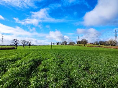
As with last month’s walk, stretches of the walk are along country lanes, but you will also discover woodland tracks and cross attractive meadows.
There was one part that was completely flooded, but I was able to pass by using a bank and a conveniently placed metal bridge. To avoid such an experience, you may wish to wait for a period of drier weather before attempting the walk.
I managed to get round without too much trouble, but I can be a bit gung-ho with that kind of thing, so I’ll leave it up to you.
Starting Point
I parked in the Bonc-yr-Haford Country Park car park, which is on Hafod Road. The postcode is LL14 6HF, and its WhatThreeWord location is what3words.com/noun.irony.saves.
If you’re coming along the A483, leave at junction 3 and head towards Rhosllanerchrugog on the B5605. You’ll go through Pentre Bychan and turn left onto Corkscrew Lane after a minute or so (look out for the converted motorhome just before the turning). Weave your way carefully along Corkscrew Lane for about three to four minutes. Turn right into the country park car park shortly after you pass the turning on your left that takes you over the A483.
The total ascent is just over 410 feet or 125 metres, with the highest point being 435 feet or 133 metres.
The map is available online at explore.osmaps.com/route/20349655 if you have an OS Map subscription.
Overview
The walk is reasonably dog-friendly, although you do pass through fields with sheep. You have to lift a dog over several stiles. It is about 7 miles long and should take about 3 hours.
Important: You must read and understand the disclaimer on our website before attempting any of our walks: love-wrexham.com/walk-disclaimer.
Walk Directions
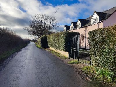
Over the A483 Exit the car park (1) onto Hafod Lane – the road you came in on. Turn left, walk for a short distance and turn right onto the road that takes you over the A483. You’ll see a public footpath sign on your right almost immediately.
Step over the low metal road barrier and make your way down the short, mossy slope to the stile. Take special care when climbing over it, as the bottom step is on a slant and is incredibly slippery on the far side.
Follow the field around the right of the Tŷ Coch Farm garden hedge. Once in the open field, look to the far side of the field, and the stile to exit it is just to the left of the telegraph pole.
Hop over the stile and walk straight across the next field. The stile you take to leave the field is just to the left of the telegraph pole in the far hedge and fence line.
Black Brook
You’ll find yourself on a lane. Turn right and walk along it, crossing the bridge over Black Brook. Walk past the signs left and then right for Wat’s Dyke in Middle Sontley. Follow the lane as it turns sharp left by a solitary redbrick house and then sharp right at the sign (2) you are entering the Erddig estate (check love-wrexham.com/2022/10/09 to see a previous walk covering this area).
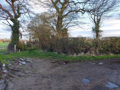
Keep following the lane, turning right onto the footpath by the sign a few minutes later. Head for the left-most telegraph pole and go through (or over) the metal cattle gate in the hedgeline beyond. You’ll find yourself on a lane. Go straight over and in between the two houses so you’re on the bridal path leading gently downhill (3).
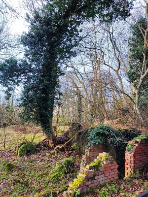
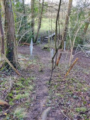
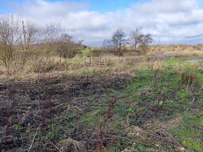
Carry straight on past the short wooden bridge to your left and the steps cut into the bank on the right. Pass the red brick remains on your right (4). The next area may still be underwater if you’re attempting the walk in the weeks after the magazine publication.
I bypassed this flooded section by carefully walking along the left side of the muddy bank and then hopping onto the metal bridge.
Gefeiliau Brook
Once over the bridge over Gefeiliau Brook, carry straight on along the path, which should be clear on the other side. Follow the bridal path to the left as it slopes uphill. Turn right when you reach the lane and walk for about 0.75 miles.
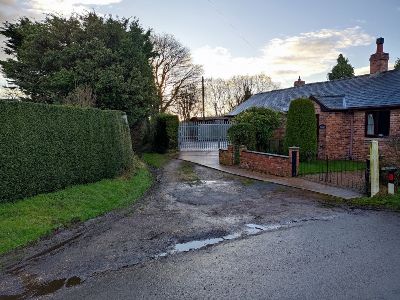
You’ll walk past Clay Pits Cottage on Clay Pits Farm on your left and The Hayloft on your right. Turn right into the field at the green public footpath sign just past the pink house on your right called The Orchard (5).
Follow the right-hand hedge and fence line. Go through the gap in the hedge and fence line and then along the left side of the hedgerow after that. Enter the next field through the gateway and over a plastic pipe.
You’ll see a ladder stile in the far hedge and fence line that leads into a wooded area. Turn left along the path. There’s a rather dilapidated stretch of fencing on your left. Carry on as that left fence improves and one on your right appears too. The fences will turn right downhill and take you over a metal bridge in a dip (6). Climb over the two-rung wooden stile.
B5426
Walk the short distance across the next field, hop over the stile and turn right on the busy B5426. Take care, as this stretch does not have a pavement, although there is a grass verge on the left. Walk for a short distance up a hill and follow the green public footpath sign on the left just after the 50 mph sign. Climb the gate as there is a stile here to access the footpath.
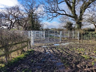
Follow the left-hand fence and hedge line. Walk through the gateway into the next field. Follow the hedge, fence and tree line on your left. Exit the field through the series of large, metal cattle gates (7) and turn left on the next lane.
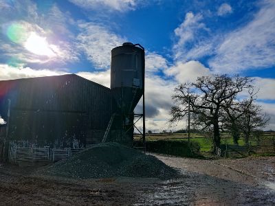
Follow the lane as it passes the front of Lower Moreton Farm and over the cattle grid. When you reach the next farm buildings, turn right at the large raised hopper on your left and the pool on your right (8).
You’ll walk down a farm track into a large open field. Walk up the field, aiming for the far-right corner (9). Hop over the righthand stile and walk diagonally right across the field. Exit the field through the metal walker’s gate. You’re now on Wat’s Dyke Way.
Walk down the field, keeping the fence, hedge and tree line on your left. Exit the field through the metal walker’s gate, across a short bridge and over the stile. Do the same in the next field, i.e., follow the left-hand hedge and fence line and exit the field over the springy slatted wooden bridge and through the metal kissing gate.
Wat’s Dyke Symbol
Walk past the stile in the left-hand hedge line and walk through the gap in the hedge ahead of you. At the end of the hedge line, walk straight on into the next field (you could use the stile to enter this next field, but it’s behind the open metal cattle gate, so you may as well just walk through this open gate).
Follow the left-hand fence, tree and hedge line. Hidden away in the very left-hand corner of this next field is the stile you use to exit the field. Take care going down the short, slippery slope. Turn right around the gate and go over the stile with the missing rung and the Wat’s Dyke symbol.
Follow the left-hand tree, fence and hedge line again, exit the field and do the same in the next field. The stile you use to exit this field is in pretty bad shape, so be careful.
Keep following the left-hand hedge and fence line in the next field. Exit over another rather dilapidated wooden stile. Follow the left-hand hedge again and exit this next field over a double wooden stile separated by a short wooden bridge covered in metal mesh.
Continue to follow the tree line on your left. Keep to the left and you’ll find yourself on a raised stretch of path running through some trees. Walk past a small clump of gorse and over a collapsed stile.
One Oak House
Carry on along the thinly wooded path until you come out into an open field. Follow the right-hand border of the red brick One Oak House and you’ll see a stile in front of you that takes you back over the B5426.
Climb over the metal cattle gate in front of you, which you have to lift slightly to open. Walk along the right edge of the hedge in front of you. After a couple of minutes, you leave the field as you walk along a path enclosed by trees and hedgerows on your right and left.
Climb over the metal gate that’s fastened with barbed wire. Follow the hedge, fence and tree line on your left. Hop over the stile to exit this field. Keep following the hedge, fence and tree line in the next field.
Tucked away in the left-hand corner of this field is the stile you use to exit this field. Hop over the other stile in front of you. You’re now leaving Wat’s Dyke Way.
“V-Shaped” Wooden Bridge
Walk through the metal walker’s gate with the dint in the top bar. Pass the pond on your left and walk along the narrow path with the fence on your right and the holly bushes on your left. The holly appears on your right as well after about a minute.
Carry on along the track until you reach the metal walker’s gate. Turn right up the bank after you go through it. Cross the “V-shaped” wooden bridge (10) and carry straight on.
You’ll pass a small lake on your right and then go through another metal walker’s gate. Pass the grove of silver birch on your left. You’ll then pass a building on your left. Follow the hedge and tree line on your left.
Go through the metal walker’s gate in the hedge on your left. Turn right and follow the vehicle track over the A483. Turn right after a few minutes onto Hafod Road. Walk past the tile showroom and the cement depot on your left. The Bonc-yr-Hafod car park is a short distance ahead on the same side.
Congratulations – you have finished! If you’d like to see some more of our walks, click here.
