
This month’s walk takes you on a loop to the east of Lavister, Darland and Rossett. You’ll also be going international as you cross the Welsh-English border at several points along the way!
The total ascent of the walk is nominal at about three feet. The highest point is just over five feet. The map is available to view online here.
The walk is about 7½ miles long and will take between 3 and 3½ hours.
Overview
You will encounter stretches of grass or nettles that are about knee-high, so you may want to wear gaiters or long trousers. The walk is not really dog-friendly as you pass through fields with cows and sheep. You might have to lift your pooch over some of the many stiles.
You must read and accept the disclaimer on our website before attempting any of our walks: lovewrexham.com/walk-disclaimer.
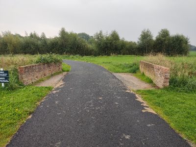
Grosvenor Pulford Hotel
We started the walk at the Grosvenor Pulford Hotel. Turn right out of the car park and walk for a couple of minutes before taking the turning on the left opposite the vet’s (you’ll cross the border into Wales at some point along this stretch).
You’ll see a sign for “Gittins Wealth Management”. Walk up the drive for a minute or so and then leave it to the right (1) before the grove of trees and just after the bridge over Lavister Brook – the first of many bridges you will cross on the walk.
Walk to the right of the trees and then follow them round to the left. Head towards the sewage farm ahead of you. Go through the gap in the hedge to the right of the fallen tree. Follow the path through the woods for a few minutes.
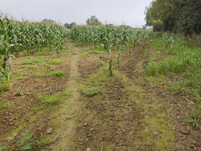
Turn right on the sewage works access road and then immediately left through the gap in the trees. Follow the path through the woods, pretty much straight on for a minute or so before following the path round to the right. You should see a field on your left (it might have tall stalks of corn in it during the growing season).
“The Elms”
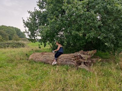
Keep to the path so you’re walking to the right of the tree and hedge line with the field on your left. Hop over the fallen tree trunk with the section cut out of it (2).
Carry on in the same direction, hugging the left fence and tree line. Walk over the short wooden planked bridge and go through the staggered wooden gateway. Walk clockwise around part of the large pond.
You’ll notice the cornfield on your left stops and is replaced by a high wooden fence. Follow the path around the pond. Go through the gap in the metal fence on your left after about five minutes and turn left onto Darland Lane.
Walk down the lane for about five minutes. Turn left when you pass the derestricted signs (3), following the left-hand metal public footpath sign.
You’ll walk past the front gate of “The Elms”. Carry on along the grassy path with the residential wooden fencing on either side of you. Turn right just before the corrugated iron shed.
The narrow path ahead of you should be clear of nettles, but it will probably be overgrown again! Turn left at the end by the wooden waymarker post.
We hope you’re enjoying “Walk Around Pulford and Trevalyn Meadows”. Click here to see more of our walk features.
Bridge Over Pulford Brook
You’ll find yourself in a field (again, there may be towering stalks of corn, maybe not – it all depends on the time of year). Walk straight on through the gap in the corn towards the group of tall trees. You’ll pass an overgrown pond on your right after a couple of minutes.
Turn right here, following the yellow wooden waymarker arrow. Cross a short wooden bridge with metal mesh. Follow another waymarker arrow to the right. Pass a green plastic water tank on your right. Walk along the right-hand hedgeline.
Break diagonally left away from the hedgeline after about a minute or so, following the gap in the corn (4) or the path trodden in the field by walkers.
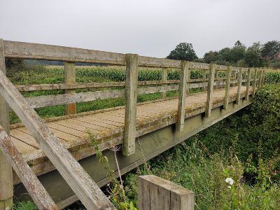
You should be heading in a northeasterly direction. You’ll come to a wooden bridge after a few minutes that takes you over Pulford Brook into England (5)!
Cross the bridge and turn right off the last step, following the direction of the waymarker arrow on the bridge. Turn left (or east) after a few yards and head through the gap in the corn or along the path trodden into the field. Head right off the path as it starts to rise, following the arrow on the wooden waymarker.
Two Raised Areas
Follow the overgrown grassy path across the gentle slope. You’ll now have the cornfield down to your right. Follow the next wooden waymarker arrow to the left. Walk along the narrow strip (it was a narrow strip when we were there!) between another cornfield on your right and a hawthorn hedgeline on your left.
You’ll pass a dead tree in the left-hand hedgeline and as the field opens out, you’ll notice two raised areas of vegetation over to the right of the field that look a little like barrows. Walk to the corner of the field in front of you and follow the wooden waymarker arrow to the left.
Walk past the gap to your right and follow the right-hand hedge line until you reach the end of the field after about five minutes. Turn right through the gap in the hedge and follow the grassy track with the hedgeline on your left for a few minutes.
When you reach the stile on your left, turn right and walk across the field. You are now heading south. Follow the waymarker arrow and path to the left as it bends around a pond.
Chapelhouse Farm
Follow the next waymarker arrow through the gap in the fence. You’ll come out into an open field. Follow the hedgeline to your left in an easterly direction for about 7 to 8 minutes.
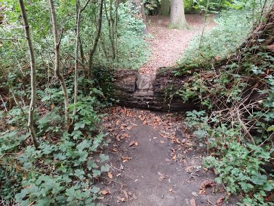
When you reach the oak tree with the large fallen branch lying on the ground, take the path to the left as you look at the oak tree (6).
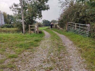
You’ll see the path is concreted over for a couple of hundred yards. Walk through the wooded area with the building debris. Follow the path to the left of the large oak tree. Hop over the stile or go through the gate and walk up a driveway. Turn right at the end of the drive. Walk down the lane until you reach the No Entry signs to the Chapelhouse Farm estate in front of you.
Turn left along the bridal track. You’ll be on this track for about the next 20 minutes and will pass back into Wales at some point. Cross the stone bridge over Pulford Brook (7).
Walk past the pumping station on your left. Follow the smaller brook on your left across the field. As you cast your eye over the far hedgeline, you’ll see a small wooden structure more or less in front of you.
Meadow House
This structure is a bridge that you take to leave the field. Once over the bridge, head for the far right-hand corner of the field. Go through the metal walker’s gate and follow the left-hand hedgeline in the next field.
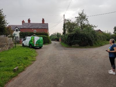
The field narrows as you reach the end. You’ll walk to the left of a blue post. Go through the metal cattle gate onto a narrow grassy path. Walk along the path for a few minutes until you come to the white Meadow House (8).
Walk along the lane for a few minutes and follow the sharp bend to the left. You’ll walk past the two curious triangular brick structures – apparently part of a flood defence (9).
Pass the farm on your right with the military mannequins and turn right at the T-junction onto Almere Ferry Road. Walk the short distance to the junction with the Griffin Inn dead ahead.
River Alyn
Turn left down Rossett Road (B5102). Take your first right after a couple of minutes. Pass the farm and go through the metal walker’s gate on your right just before the bridge over the River Alyn. Follow the River Alyn path along the lefthand tree line and river, step over the low wooden bar after a few minutes. Refollow the river.
Hop over the stile into the next field. Walk along the narrow path between the river and an overgrown wooden fence. You’ll go through a short wooded area and then into another field. Head for the white houses, keeping to the left hedgeline.
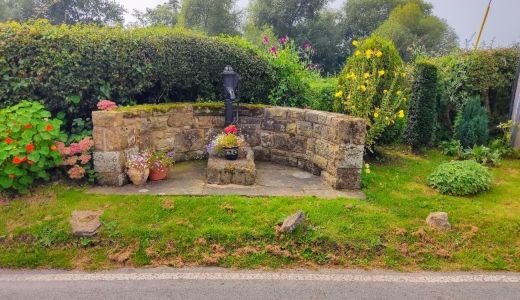
Climb the stile and turn left onto Harwood’s Lane through the little village of Trevalyn. Walk past the quaint water pump (10) and continue until you reach the green metal footpath sign and the walker’s gate on your right after a few minutes.
Darland Playing Fields
Go into the field and walk along the narrow grassy path, keep the metal fence to your left. Go through the metal walker’s gate onto Rossett Road again. Turn right and then immediately left. Hop over the stile and follow the well-trodden path and line of telegraph poles.
Start following the left-hand hedgeline and exit over the stile ahead of you. You’ll see Darland High School playing fields on your left. Turn left up Gamford Lane. Turn right onto Darland Lane after a few minutes – mind the traffic – and turn left when you see the sign for Lake Cottage on your left after about a minute.
Walk up to the end of the short lane until you come to the open field. Walk across the field in front of you following the path in the grass. You’ll pass the sewage farm on your right from the beginning of the walk. Walk to the left of the clump of trees and turn left once back onto the drive that will take you up to the vet’s on Wrexham Road (the B5445).
Turn right and walk back up to the Grosvenor Pulford Hotel. Congratulations! You have finished the walk.
Click here to see more of our walks.
