Overton and River Dee walk. This month we feature a five-mile walk around Overton and the River Dee (via Knolton Bryn and Llan-y-Cefn Woods). This walk is the second of three around Overton that we are featuring. Click here for the first.
Distance: 5 miles (8km)
This route is not suitable for wheelchairs, buggies and small children.
There is a bus service to Overton from Wrexham and Whitchurch, including one on Sundays. Call Travel Line on 0800 464 0000 or visit their website for more details.
This pleasant ramble is mostly across undulating meadowland with extensive views of the surrounding countryside and the Dee Valley. The route, like all others in Overton, is comprehensively waymarked.
Follow the directional yellow arrows to find the next stile or gate. This route is not suitable for wheelchairs, buggies and small children.
Disclaimer
Our walks follow public footpaths as indicated on OS maps wherever possible.
You must read, understand and accept our disclaimer before you attempt any of our walks.
Electricity House
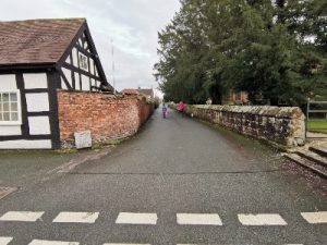
From the car park adjacent to Overton church, turn right (onto Church Road) and then left at the crossroads onto the main road (A539 Wrexham – Whitchurch). Immediately cross this road and go along the signposted gravel drive. Walk through the garden of Electricity House, keeping the house to your right. Enter the field over a low stile. Walk straight ahead across the fields over six more stiles.
Go ahead and climb the next stile where the waymarked path divides. Turn half-right. After 100 metres, cross the stile and head for the large circular concrete cattle-trough in the middle of the field. Beyond this, the path descends to a small area of woody scrub. Cross the stream, turn right along the concrete farm track and right again at Musley Lane.
After the sharp right-hand bend, cross the first stile on the left just before the farm. Turn immediately left and retrace the hedge, now on your left, continuing through several farm gates and fields until you reach a small gate. Go through the pine woodland. In the following field, turn half-right, passing the pond on your left, heading towards the gate.
Knolton Bryn
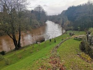
Go through the stock pen beside the sheep-dip and climb over the stile immediately on your right. Follow the hedge on your right. Twenty metres before the end of the field, cross the stile and bridge on your right. Turn left and walk around the pond.
Beyond the next stile and a dry ditch, walk straight across the field to the farm ahead, passing it to the right. Go through the gate and along the hedge on your left. Go through another gate and carry on until you reach the main road (A528).
Turn right and walk along the grass verge for about 60 metres. Take the first stile on your left before the lane. Keep to the right of the field and walk up the slope. After the stile, turn right into the yard and walk behind the 17th-century half-timbered barn, emerging onto a stone drive. Turn right along the drive and pass the site of the former corrugated iron church of Knolton Bryn (now a house – see main image). Turn left and left again at the first tarmac junction in about 20 metres.
A Large Oak Tree
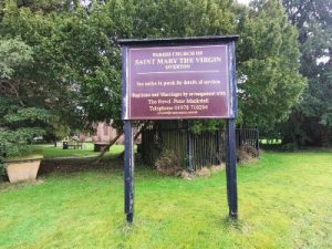
Go straight on up the driveway and take the stile a few metres past the house. Keep to the left of the field until the hedge swings away to the left. Keep straight on across the field and you will see the stile adjacent to a gate under a large oak tree.
Ignore the waymarked path leading to the right, but walk ahead across the following field to the stile by a gate. Keep to the left of the next field, walking past the water trough. Continue along the hedge on your left past a pond and another water trough. Cross the stile in the corner by the gate. Stay on the left boundary and then keep the farm building on your left to find the stile in the corner of the field.
Turn right along the farm track to the lane and turn left. Walk along the lane, looking out for a stile on your right after about 50 metres (if you come to a house on your left, you have gone too far!).

Woodland Conservation Area
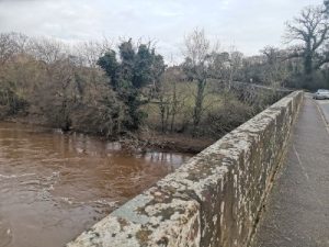
Once over this stile, stay beside the hedge on your left and cross the stile and small footbridge at the first field corner. Go straight across the field/part football field to the next stile. Walk alongside the hedge on your right and cross the stile in the right-hand corner by a scrub-hidden pond. Walk along the left-hand boundary, go over another stile and continue along the hedgerow as it swings to the right. Pass a pond on your left.
After 150 metres, near the end of the field, cross over the stile on your left and turn right along the hedgerow. The stile takes you through a small woodland conservation area planted in 1990. Look diagonally left across the following field. The stile is where the fence ends and the hedge begins. Cross this stile and go alongside the hedge on your right. Where the hedge swings off to the right, keep straight ahead. Go over the stile and the next one in 15 metres. Keep to the right through the grounds of a converted barn.
Llan-y-Cefn Wood
At the main road (B5069 Overton – St Martins), turn left and immediately right along the tree-lined driveway. At the black and white gates and cattle-grid, turn right over the stile into the field. Walk down the slope and cross over the stile in the corner of the field. Follow the path over several more stiles into Llan-y-Cefn Wood. Go down the clearly defined way to the River Dee. Turn right along the riverside path, noting as you go the old hydraulic ram formerly used to raise water to a house above the river.
Cross the footbridge and follow the riverside over open farmland. After 400 metres, turn right along the track towards the village. At the corner, turn right behind the sewage works and cross a brook at the end of the chain-link fencing. Turn left up the steps and left again at the top. Follow the path through the wood to another set of steps leading to Salop Road. Turn left, cross to the pavement and go over the crossroads, returning to the car park.
About the Countryside and Council Walks
Please report any problems to rightsofway@wrexham.gov.uk or 01978 292 057.
FOLLOW THE COUNTRYSIDE CODE RESPECT – PROTECT – ENJOY
- Be safe – plan ahead and follow any signs
- Leave gates and property as you find them
- Protect plants and animals and take your litter home
- Keep dogs under close control
- Consider other people
Please report any problems to rightsofway@wrexham.gov.uk or telephone: 01978 292 057
Route taken from the council website. There is also a map available at that link.
Many thanks to Wrexham County Borough Council for supplying us with this walk. Please visit wrexham.gov.uk and look for ‘self-guided walks’.
We hope you enjoyed our article about ‘Overton and River Dee walk‘. For more of our features on local walks, please click here.

