This walk starts by the Boat pub in Erbistock (LL13 0DL) and follows the north bank of the River Dee for two miles, then goes to higher ground with some magnificent views. The walk is 4¼ miles long. The stiles and gates along the route are dog-friendly, but you do walk through several fields of sheep.
There are also two roads you can take to reach the pub. One runs behind the Cross Foxes pub situated on the Overton Bridge over the River Dee on the A528. The other is opposite Cae Gwydd Farm (LL13 0DG) on the A539.
Disclaimer
Our walks follow public footpaths as indicated on OS maps wherever possible.
You must read, understand and accept our disclaimer before you attempt any of our walks.
The Boat and River Dee
Stand with your back to the pub, turn right and walk through the car park. Go through the gate in the wooden fence on the left. This spot is a favourite of fly fishers and is the home of the Prince Albert Angling Society.
The path is pretty clearly marked now for the next two miles. If in doubt, stick to whichever way runs parallel to the river. It will be muddy in places, and take special care if there has been wet weather.
You will see Manley Hall above you to the right after about 100 yards and, shortly afterwards, the footbridge over Shell Brook on the opposite side of the river, A green kissing gate leads to a wooded bank, with several attractive wildflowers, such as; wild garlic, daffodils, and ferns like Hart’s Tongue Fern, Pendulous Sedge and Spurge Laurel. You will see the first of several small exposed sandstone cliff faces to your right.
The Weir and Sandstone Rocks
After passing a weir and rounding a prominent bend in the river, you’ll cross over a short wooden footbridge. Go down some wooden steps and the metal guardrail on your left. You can see the weir control house on the far side of the river. Take your time going over the rocky outcrop and then cross a second wooden footbridge. Be mindful of the first section as it has collapsed on the right-hand side.
After 0.65 miles, you’ll come to another semi-collapsed wooden bridge. Continue along the riverside path, enjoying the woodland on your right. You’ll have to negotiate some sandstone rocks at one point. Cross a wooden bridge just before you exit the wood. You now have a fence and a field to your right with six oak trees in it. The large white house at the top of the hill has a stunning view of the river and beyond.
Wat’s Dyke Way
You will cross a V-shaped bridge with a small sign saying “Wat’s Dyke Way” and a little further along the oak-leaf carpeted path, you will come to a tree full of fishing notices just before a curious double-gated wooden bridge (one-mile point). Take the wooden step up to the right and go through the V-shaped stile (or round it; there was nothing to prevent me doing that when I encountered it). You can see a large red brick house across the field to your right (photo no 1).
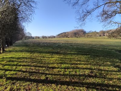
Carry on along the river path. There’s a slight depression on your left with the remains of a brick wall. You’ll see the area around the track narrow ahead of you. Go through what obviously used to be the gateway to the following field and descend into an attractive meadow. Go straight on along the path following the river. After about 200 yards, you’ll see an exit gate in front of you.
Please note that although the field was empty when I scouted the walk, one group has subsequently reported a herd of cattle behaving in an intimidating manner in this area.
Graig Farm And Farmhouse
Continue to follow the river in the next field as it bends round to the right. Notice the curious west-to-east line of oak trees, spaced in a one, two, one formation. Go through the green kissing gate to exit the field (photo no 2). You’ll now be heading upwards on an unsealed track (two-mile point). Hop over the stile and join the sealed lane, ignoring the left turn and also listening out for woodpeckers.
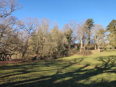
You’ll go past Graig Farmhouse on your right and Graig Farm on your left. Turn right onto the drive to Wyffydd Pen y Lan by the green metal footpath signpost and the picture of the pheasant on the letterbox (photo no 3). Go through the gate and along the drive. Go straight on at the point the drive bends round to the right.
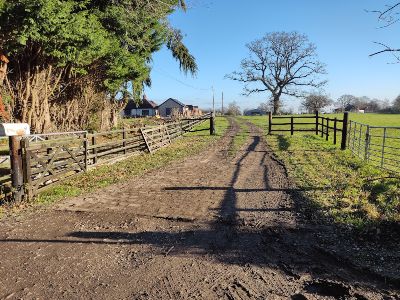
Circle of Oak Trees
Go through the metal kissing gate. You’ll see a curious circle of oak trees – pass it on the left.
Take a minute to appreciate the truly magnificent views left and right.
Carry on pretty much straight on (or due east if you’re carrying a compass). You’ll see some semblance of a path heading downhill on a slight left diagonal. Keep the line of trees ahead to your immediate left. You’ll see a waymarker on an old wooden gatepost (photo no 4). The line of trees to your left becomes a dip with holly and oak trees at the top of each side. Make your way down the slope.
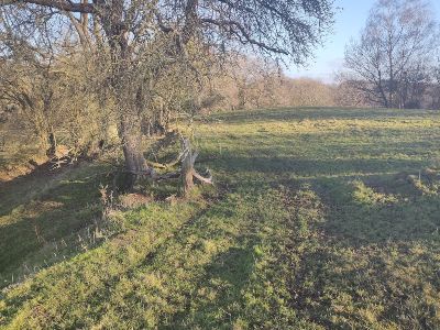
On your way down, you’ll be able to make out the chimney of a cottage at the bottom of the hill. As the trees on your left peter out, watch out for a waymarker leaning against an oak tree on your left. Start to walk towards the telegraph pole in front of you (photo no 5).
Stop halfway and look to your right down the hill to take in the fantastic view. You’ll also see the field you entered after the double-gated bridge.
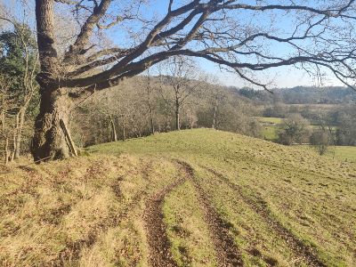
Turn left and go down the slope (bearing northeast). There’ll be a waymarker in front of you. Follow the arrow to the right and past two more waymarkers. A light-mustard-coloured cottage will appear in front of you.
Erbistock Hamlet
Go through the wooden kissing gate with the waymarker on it (three-mile point). Walk past the front of the cottage and turn left, ignoring the footpath sign straight on. Go up the road, passing the house called Plas Pen-y-Bryn. Turn right at the T-junction and take the first turning on the left onto Cae Adda Lane.
Hop over the stile on the right after about 50 yards and go through the gate. Head straight down the hill (walk towards the white house that usually has a flag in the back garden). Go through the wooden kissing gate onto the lane and turn right (photo no 6). Walk through the hamlet of Erbistock and then take a left at the T-junction.
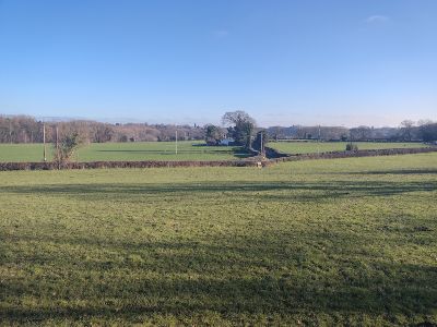
Carry on down the lane. After about 50 yards, you’ll see a sign for the cemetery and the entrance gate to Wingetts Garden (four-mile point). Continue along the lane. Turn right through the church gates immediately after the two barns with the red, wooden, first-storey doors. Follow the path around the front of the beautiful little church and carry on along the gravel path until you can drop down to the road on your left (photo no 7). Walk on a few more paces, and you are back in front of the Boat at Erbistock.
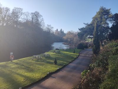
Congratulations! You have completed the walk!
Finally, thank you for reading ‘A Stroll Along the River Dee Then Over the Hills to Erbistock’. To view our previous walks, click here.
The main image is St Hilary’s Church, Erbistock next to the Boat Inn.

