
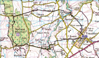
This month’s walk takes you on a loop west of the remote village of Treuddyn, with its highlight being the section taking you up to and through Nercwys Forest.
The ascent isn’t particularly steep, but it does take about 45 minutes, so it will have you breathing heavily! The path you take for the first part of the ascent is stony but easy to walk on, and then you walk up a lane for the second part.
The total ascent of the walk is nearly 1,000 feet, and the highest point is just over 1,200 feet. The map is available to view online at explore.osmaps.com/route/18163537 if you have an OS Map subscription.
Overview
You will have to walk over quite stony and uneven paths at times so a pair of stout boots is recommended. Some fields have patches of grass that are about knee-high, and you may want to wear gaiters or long trousers.
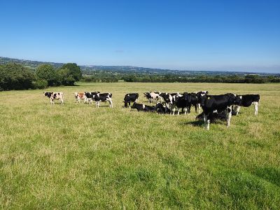
The walk is not really dog friendly as you pass through several fields with cows and sheep. You might have to lift a dog over some of the many stiles you will encounter. It is about 6½ miles long and will take between 2½ and 3 hours.
Disclaimer
You must read, understand and accept the disclaimer on our website before attempting any of our walks: love-wrexham.com/walk-disclaimer.
Queens Street Car Park
Queens Street Car Park is free to use and is in the middle of Treuddyn, postcode CH7 4LT. It is the ideal place to start your walk. Turn left out of the car park and walk up to the T-junction. Turn left onto Fford Y Llan, up the hill, and over the crossroads onto Fford Carrey-Y-Llech.
Hop over the stile on your right after about a minute and just before the house with the large grey gable end. Follow the fence and hedge line to your left and climb carefully over the slightly awkward wood and stone stile. Take a moment to look north for some amazing views of Mold and, in particular, Mold Church (1).
Tŷ Isaf
Turn sharp right and follow the hedge line for a few paces. Cross the first stile, walk along a short wooded path and cross the second one. Turn left and follow the hedgeline downhill. Go through the gap in the hedge and fence line ahead of you. Keep the same line when you’re in the next field. You’ll walk past the house called Tŷ Isaf. Exit the field after the house using the narrow metal fence (2) to the right of the large cattle gate. Hop over the fence, go over the short wooden bridge and turn right onto Fford Y Felin.
Follow the lane downhill for a couple of minutes until you reach the white cottage on your right. You’ll see a green metal public footpath sign indicating right. Turn right and walk between the two houses. Take the left fork at the bottom of the short lane, pass the damson tree, and walk onto the lawn of the house you just passed.
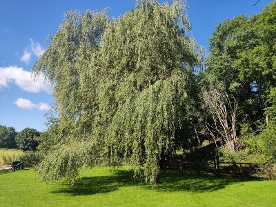
Splendid Willow Tree
On the other side of the rather splendid willow tree (3) and in the far corner of the lawn is a stile with a yellow public footpath arrow on it. Walk along the 25-yard-long narrow path between the two fences and cross the green metal bridge with two stiles. Turn left once over the bridge. Once you’re in the open field, head diagonally right up the slope and go through the gap in the fence and hedge line at the top of that slope. Follow the hedge and fence to your left until you reach the stile next to the cattle gate.
Manoeuvre yourself over the stile and follow the right-hand hedge and fence line for about three or four minutes. You’ll see a stile next to the cattle gate in front of you. The stile is overgrown with nettles, so the gate is probably a better option. You find yourself at a T-junction. Go straight over and up Fford Plas Ucha, passing the beautiful house called Tŷ Coch. Shortly afterward, climb the partly overgrown wooden steps on your right by the public footpath signpost. Cross the stile and follow the right-hand wall and hedgeline.
Ty’n-Yr-Ynn
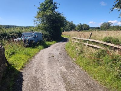
Go through the open gateway in the hedge line ahead of you and then up the field through the energy-sapping long grass. Pass the metal stile on your left. Keep following the left hedge and fence line. As you reach the farmhouse (Ty’n-yr-ynn) at the top, exit the field through the wooden gate in the stone wall on your side of the house as you look at it. Turn left and walk for a few paces. You have two options here. Follow the public footpath by climbing the stile on the other side of the lane to the abandoned Land Rover (4), turning left and walking along the field until you reach the stile by the wooden gate. Again, long grass in this short stretch seriously slows you down! You could simply walk up the lane and climb over the wooden gate, but that is not the official route.
Once on the other side of the gate or the stile, walk up the lane passing two houses; Old Gelli Farm is the building on the left. Turn left at the T-junction. You’ll see a public footpath signpost almost straightaway on your right. Climb over the stile and walk up the field in the general direction of the forested area above and in front of you. Exit the field over the stile in the left-hand fence line after a short distance. You’ll find yourself on an uphill stony track. After about 8 minutes, you’ll come to a T-junction.
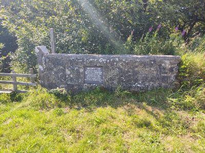
Coed Nercwys
This is the entrance to the Coed Nercwys area and you can see an informative plaque in the wall ahead of you (5). Carry straight on up the steepish road for about 10 minutes before turning left onto the grassy path opposite the white cottage called Woodlands.
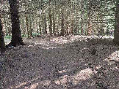
Walk along the grassy path amongst the trees for about seven minutes before you reach a fork with some information boards. Take the left fork. The trees gradually disappear and you’ll start walking through more open land. Go past the two signs for Llyn Ochin. The path begins to descend and takes you back into a pine forest. After a few minutes, you’ll notice a track going off to the right as your path turns sharply to the left (6). Take this right-hand path, which bends left after a few paces and goes from pine needles to grass.
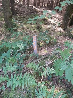
You’ll know you’re on the right track because you’ll see a short, crooked wooden post with “End” written vertically in orange paint on your right a few paces after the bend to the left (7).
Black Mountain
The path starts to descend, and after about 7 or 8 minutes, you’ll arrive at a stony track running across you. Turn right and go through the forest exit gate. You’ll find yourself on a lane called Black Mountain – turn left. You’ll now stay on this road for about a mile and a half (about 20-25 minutes). After a couple of minutes, you’ll pass a bench next to a nearly obscured sign with some very patriotic words. You’ll also pass a building on your right with two red shutters just before a bridge and a magnolia coloured cottage.
The road twists and turns, but when you reach the 1.-mile mark, you’ll notice how the road bends sharply right, and there’s a corrugated steel double barn (8) on your left and a metal cattle gate. You turn left here before the barn into the field through a metal walker’s gate. There’s a rusty pole by the gate which probably used to have a public footpath sign on it. Head diagonally left across the field, walk to the right of the electricity pole, and hop over the stile in the hedge and fence line in front of you. Walk to the right of a second electricity pole standing alone in the next field and hop over the stile next to the large cattle gate ahead of you.

Fford Y Odyn
Cross the lane called Fford Y Odyn and take the wooden stile with the initial stone step opposite. Ignore the stile dead ahead over the rise of the field. It’s too rickety and overgrown to cross safely. Instead, exit the field using the cattle gate at the righthand end of the hedge and fence line in front of you. Walk pretty much straight on towards the next metal cattle gate. Exit the field using the stile to the right. Hug the right-hand hedge line of the next field and hop over the metal stile onto Fford Nercwys. Take care with the stone steps on the other side of the stile as they may be slippery if it has been raining. Cross the lane and climb over the stile into the next field. Follow the right hedge line for a few yards. The hedge will bend away to the right at a 45° angle. Ignore this and walk straight on, aiming for the right corner of the field ahead of you.
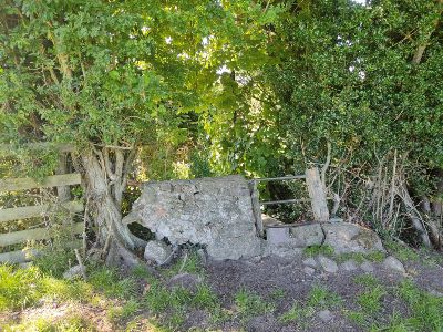
Fford Y Rhos
Exit the field over the curious stone stile (9). In the next one, follow the short left hedge line and hop over the stile in the left corner (don’t take the other stile a few yards to the right by the house). In the next field, follow the left hedge line and go over the stile in the corner ahead of you.

Walk along the left hedge line and exit this field through the metal kissing gate in the left corner by Ebeneser church (10). Turn left and walk along Fford Y Rhos for a minute or so. Turn right again by the yellow gate and go down the concrete path following the public footpath sign. Walk along this path for a couple of minutes until you reach the Queen Street car park again. Congratulations – you have completed the walk!
If you’d like to see some more of our walks, click here.

