The Berwyn Mountains walk is 8.5 miles long, starting from the small village of Llanarmon Dyffryn Ceiriog. It crosses moorland where the path may not be very clear at times and there is a stream to cross. Bring some good boots, a map and a compass (and know how to use them). It is quite a strenuous walk so allow at least five hours.
Disclaimer
Our walks follow public footpaths as indicated on OS maps wherever possible.
You must read, understand and accept our disclaimer before you attempt any of our walks.
Start
This walk follows the upper reaches of Afon Ceiriog, forest, wild and heather moorland to return via an old drovers’ road. You may see or hear black grouse and curlews along the way. If you are lucky, you might get sight of a hen harrier.
How to get there: from Wrexham, head south on the A483 as far as the junction with the A5. Take the third exit at the roundabout and continue along the A5. At the next roundabout, take the first exit and continue along the B5070 into Chirk. Continue into Chirk itself and turn right onto the B4500 after 1.4 miles (as you leave the village, you’ll see a brown road sign indicating the right turn with ‘’Ceiriog Valley Glyn Ceiriog/Aqueduct Pont cario dwr” written on it). Carry on to the mini-roundabout and take the first exit for the B4500. Continue though the beautiful Ceiriog Valley for 11 miles to Llanarmon Dyffryn Ceiriog.

There is limited parking in the village so please park carefully. Start at the centre of the village by the signpost. Leave the village by the road for Swchcae-rhiw. You have about two miles of walking along this lane. However, there are very good and varied views along this road; it is especially fine in autumn when the leaves are changing colour.
Traffic Jam
Although there is very little traffic, take care as there is some farm traffic. At weekends you may meet off-road vehicles. When the lane becomes a stony track, turn right indicated by a footpath signpost. This is Swchcae-rhiw (there is a steep sided valley off to the right which contains several waterfalls. But we are not going that way).

A track climbs up the hillside and soon after passing a small plantation and then some small crags. The track ends and you now find yourself on a large area of moorland. There is a faint path and waymarks on posts. In mist, set a bearing of 345 degrees.
Further on, the path descends across eroding peat to a footbridge and then crosses a stile. Continue across marshy ground until you reach a track. The waymark points ahead, but turn right along this track. At the next junction of tracks, bear right heading towards the forest. Ford a small stream to a stile by a gate (note: a short distance to the left is an interesting monument to a local mining engineer James Darlington).
The Forest Track
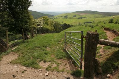
Follow the forest track (the trees have been cleared from part of this area). Bear right at the junction of tracks and up a small rise, go right again. After 70 metres, look to your right for a post with a blue bridleway waymarker and a small gate in the fence. Turn right off the track and onto the moorland. The path is clear and rises steadily with good views over towards Vivod. After about 1.5km, the path forks and is marked by a post with two waymarkers. Take the right (yellow waymark) footpath. At first, this is a clear path through heather. After crossing a stile by a boundary stone, the path might become a bit boggy in places. Keep the fence to your right and head towards a plantation.

End
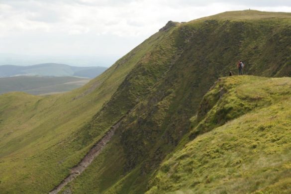
The path now meets an old drovers’ track. Turn right, go through the gate and follow the track due south. It has been badly eroded in places by off-road vehicles. The view has changed again and now prominent is the ridge of Mynydd Tarw with Cadair Berwyn and Cadair Bronwen beyond. On reaching a white cottage, the track joins two sealed lanes, bear right. It is all downhill now with views across to Llanarmon. On reaching the road, turn right, cross the bridge, and you are back in the village.
The amazing photos are courtesy of Mike Slater of Seren Web. Visit Mike’s website.

